10 Must-Try West Virginia Hikes, Ranked From Gentle To Challenging
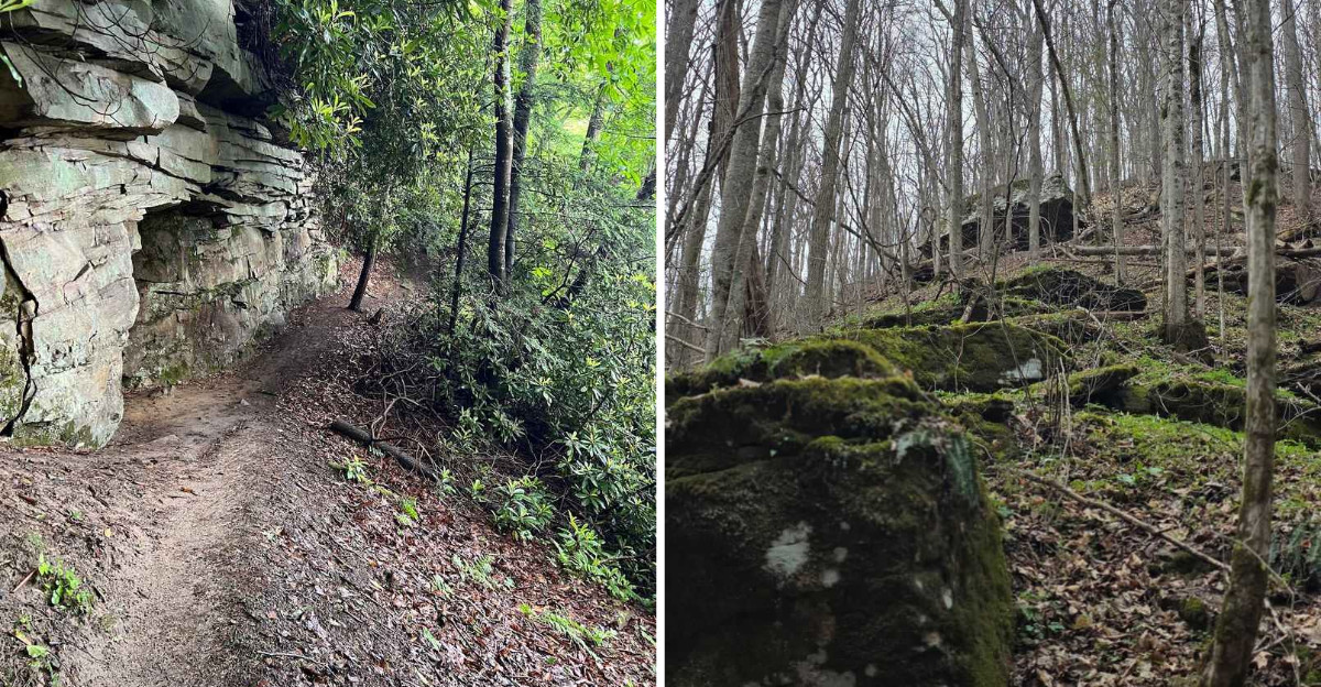
Start with an easy waterfall walk, and a few hikes later you may be scrambling across rock with your legs asking questions.
That is the fun of this West Virginia lineup, where the difficulty rises gradually as the scenery gets increasingly dramatic.
Beginners can ease in with shorter paths and accessible overlooks, while experienced hikers eventually reach steeper ridges, rocky climbs, and trails that demand more attention.
Ready to level up? Along the way, expect river views, sandstone cliffs, rhododendron tunnels, waterfalls, and sweeping Appalachian panoramas.
Each hike asks for a little more than the one before it.
Choose based on how adventurous you actually feel today, not how heroic you felt while reading the map.
1. Gentle Trail, Davis
Have you given any thought to how little effort a truly great view can require? Sometimes twenty minutes buys you a memory that lasts years.
Inside Blackwater Falls State Park near Davis, the Gentle Trail runs a mere 0.2 miles. The paved surface is wheelchair accessible, which means nearly everyone can reach the payoff.
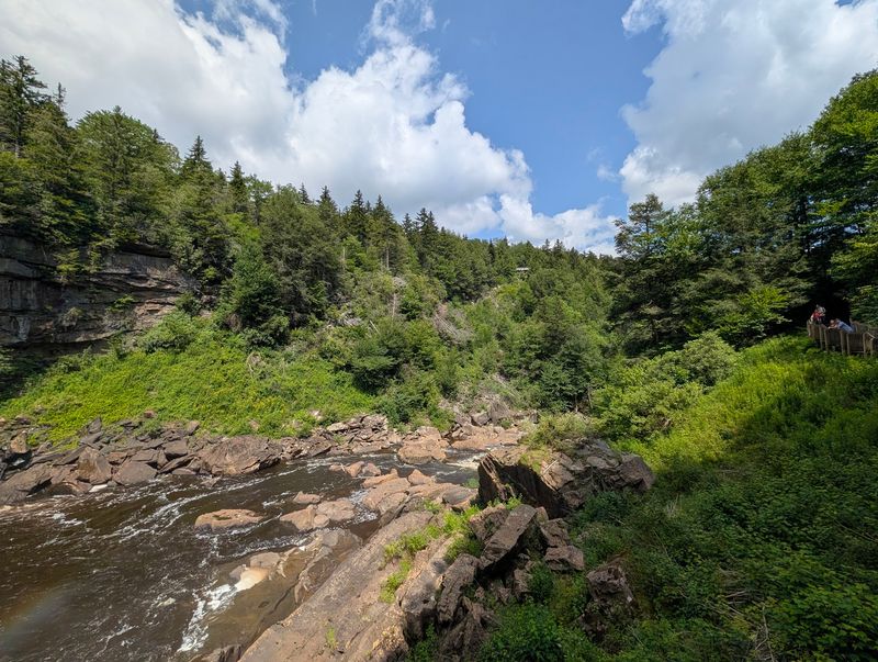
At the end sits an observation deck perched high above the canyon floor. Below you, Blackwater Falls drops roughly 57 feet in a wide amber curtain.
That unusual tea-colored tint comes from tannic acid released by fallen hemlock and red spruce needles. Nature does its own dyeing here, no chemistry set required.
Warmer months bring cool mist drifting up from the plunge pool. Green rhododendron and towering conifers frame the scene on all sides.
Photographers love the elevated angle, since it captures both the falls and the winding river. Morning light tends to be softest for pictures.
Should you want more mileage, the surrounding park holds nearly 20 miles of additional footpaths. Many connect to overlooks, boathouses, and quiet woodland loops.
The short, paved route is wheelchair accessible, making it one of the park’s easiest ways to reach a Blackwater Falls overlook.
Restrooms and parking sit close by, making logistics refreshingly simple. Winter turns the railings frosty and the falls partly icy, which is its own reward.
Find the trailhead at 1584 Blackwater Lodge Road in Davis, and prepare for enormous scenery on a tiny budget of steps.
2. Sandstone Falls Boardwalk, Hinton
Just imagine for a second a waterfall stretching nearly a third of a mile wide. Now imagine reaching it on a flat wooden walkway.
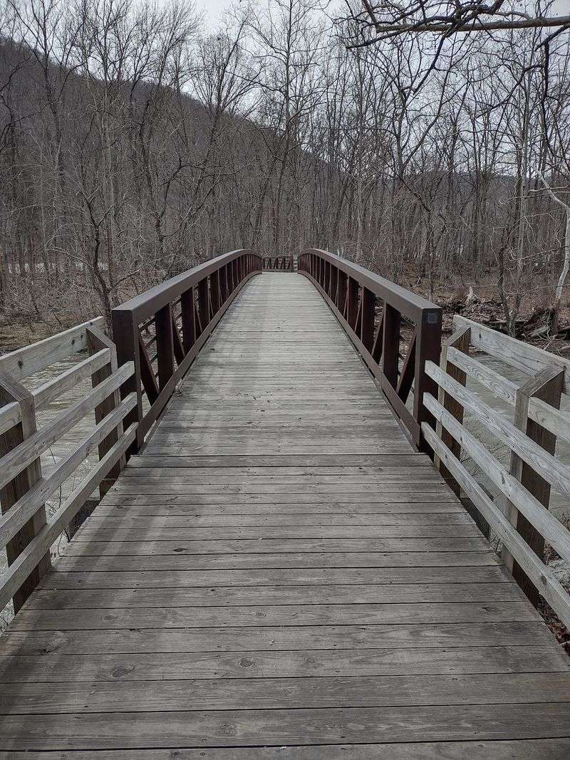
Near Hinton, the Sandstone Falls Boardwalk delivers exactly that combination of drama and ease. The accessible boardwalk runs about a quarter mile, making an out-and-back visit roughly half a mile.
Water here spills between 10 and 25 feet over a broad shelf of rock. It is the largest waterfall on the entire New River.
The boardwalk crosses two bridges and links a series of small islands. Observation decks at the far end put you close to the roar.
Anglers use these platforms too, since the pools below hold plenty of fish. Bring a rod if that appeals to you.
Along the route you pass an Appalachian riverside flatrock community, a rare habitat. Certain plants growing here survive only beside high-energy Appalachian rivers.
The boardwalk is open year-round, while the appearance and flow of the falls change with weather and river conditions. Autumn adds gold and rust to the riverbanks.
Interpretive signs explain the geology that carved this wide ledge over millennia. Kids usually gravitate straight to the bridge railings.
Because the surface stays smooth and level, wheels of all kinds roll along comfortably. Sturdy shoes still help on wet boards.
The access drive is narrow and winding, so take it slowly. Reach the falls via Sandstone Falls Road out of Hinton, inside New River Gorge National Park and Preserve.
3. Alum Cave Trail, Buckhannon
Here’s an idea: a hike that mixes river swimming, forest shade, and a geology puzzle. Audra State Park pulls it off in under three miles.
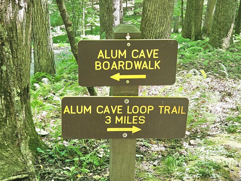
Alum Cave Trail is officially a 2.7-mile loop. West Virginia State Parks generally rates it easy, though a 2026 ranger-led hike described rocky sections and steep descents and rated that outing moderate.
Your route slips through leafy woods before reaching an enormous sandstone overhang. A wooden boardwalk tucks right underneath the rock ceiling.
Standing there, the scale of the stone above feels almost unreal. The boardwalk follows beneath the large sandstone overhang, one of Audra State Park’s signature geological features.
The enormous rock overhang gives the trail its name and creates one of the park’s most distinctive sections.
Beyond the overhang, the trail provides access to the Middle Fork River in places, where visitors can wade or explore when conditions are appropriate.
Spring carpets the slopes with wildflowers like trillium and violets. October flips the whole canopy to orange and gold.
White-tailed deer, squirrels, and woodpeckers make regular appearances. Listen for the river rushing over its rocky bed.
The boardwalk can be slick after rain, so tread carefully. Handrails help on the damper sections.
Picnic tables and a campground sit nearby, which makes turning the hike into a full day simple. Cell service is spotty, so download maps first.
Head to 8397 Audra Park Road in Buckhannon, and give yourself extra time beside that inviting water.
4. Lindy Point Trail, Davis
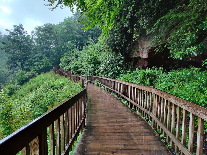
My jaw dropped the moment the trees opened up. Postcard views usually take more sweat than this.
Inside Blackwater Falls State Park near Davis, Lindy Point Trail is officially listed at 0.3 miles and rated moderate, making an out-and-back walk roughly 0.6 miles.
The path descends gently through hemlock, red spruce, and mixed hardwoods. Roots and occasional mud make decent footwear worthwhile.
Rhododendron crowds the understory, exploding into bloom in late June and early July. Those pink and white flowers are the state flower.
Then the forest parts and Blackwater Canyon spreads out below. Distant Allegheny ridges stack up in layers toward the horizon.
The Blackwater River threads through the valley floor far beneath the rock ledge. Wooden railings keep the overlook safe without blocking the view.
Sunset here is legendary among photographers, painting the canyon in copper and rose. Sunrise brings mist pooling among the trees instead.
Wildlife may appear along the forested trail, though sightings and crowd levels vary throughout the day.
Autumn is peak season, when the canyon glows scarlet and amber. Expect company on weekends during October.
Parking is limited at the small gravel area on Canaan Loop Road, so arrive early. The road can get rough after storms.
Base yourself near 1584 Blackwater Lodge Road in Davis, then let this short walk hand you one of Appalachia’s finest panoramas.
5. Endless Wall Trail, Lansing
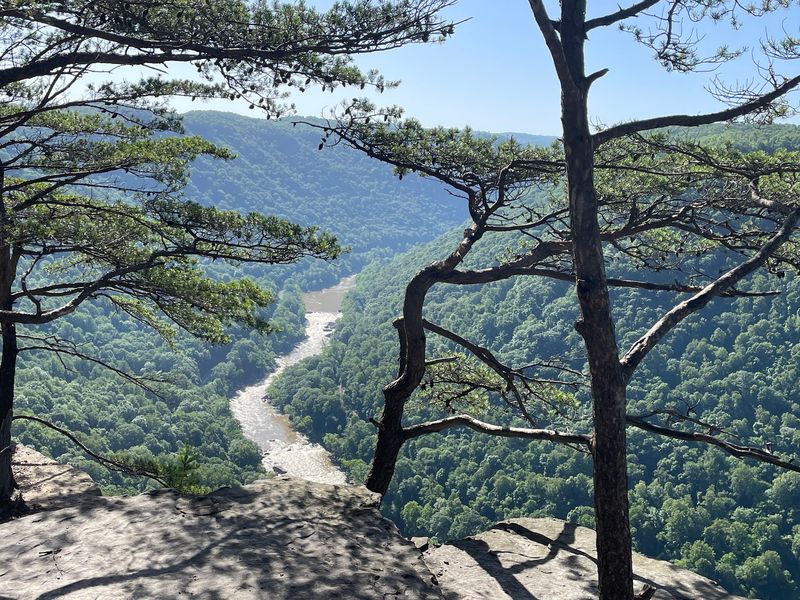
Correct me if I’m wrong, but cliffs, creeks, and thousand-foot drops sound like a full day well spent. This trail packs all three into a couple of miles.
Endless Wall Trail runs 2.4 miles from trailhead to trailhead. A popular alternative is an approximately two-mile out-and-back to Diamond Point, while completing the full trail and returning along the road brings the outing to about three miles.
Early on you cross Fern Creek on a small footbridge. Ferns and mossy boulders crowd the banks.
Then the path zig-zags along the rim of towering sandstone walls, passing several gorge vistas before reaching the major overlook at Diamond Point.
Diamond Point steals the show, with the New River nearly 1,000 feet below. Whitewater rafters sometimes shout up from the rapids.
Rock climbers frequent the sandstone cliffs below the trail, while hikers encounter uneven ground, roots, rocks, and occasional steps along the route.
Coal-mining history remains an important part of New River Gorge, though the preserved Nuttallburg mining complex is a separate destination elsewhere in the park.
Spring brings rhododendron blossoms, while October sets the gorge ablaze with color. Summer keeps things shady and cool.
Two trailheads exist, so decide in advance which lot suits you. Edges are unprotected, so keep kids close.
Look for the access along Lansing-Edmond Road in Lansing, and pack extra water for those cliffside detours.
6. Long Point Trail, Fayetteville
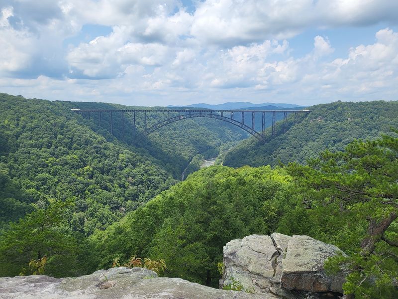
Photographs never quite capture the steel arch in person.
Long Point Trail near Fayetteville runs about 3.2 miles out and back. Rate it moderate, with one genuinely spicy finish.
Most of the walking happens under a thick canopy on soft, shaded ground. Rhododendron tunnels arch overhead in several stretches.
Watch your feet across sprawling root systems, which love to grab boot toes. Trekking poles are handy on damp days.
The final 0.2 miles is closed to bicycles and includes a short, steep section before the overlook, so hikers should take extra care near the finish.
Then the reward arrives: a three-sided cliff jutting boldly into the gorge. The New River Gorge Bridge fills the view straight ahead.
Far below, the New River curves through forested walls. Rafts sometimes appear as tiny specks on the current.
Sunset transforms the whole scene, backlighting the bridge in gold. Bring a headlamp if you linger past dusk.
Mountain bikes share most of the route, though the last stretch belongs to hikers only. That keeps the overlook calm.
Stay back from unfenced edges, especially with children or dogs. There are no railings at the top.
Parking sits along Long Point Road in Fayetteville, inside New River Gorge National Park, and the lot fills fast on autumn weekends. Arrive early and claim that cliff.
7. Grandview Rim Trail, Beaver
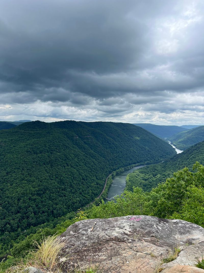
Let me be real for a second, big views should not always require punishing climbs. Here the ratio tips generously in your favor.
The Grandview Rim Trail near Beaver runs about 1.6 miles one way, making a 3.2-mile round trip. Add connecting sections and you reach roughly four miles.
Difficulty stays moderate, with a few short steep pitches. Around 150 steps appear near the far end.
Your path winds through mature forest of hardwoods, hemlocks, and rhododendron thickets. Shade keeps summer hiking comfortable.
Cliff-top openings appear repeatedly, each framing the gorge differently. The canyon plunges 1,400 feet to the river below.
Turkey Spur Overlook adds several elevated vantage points over the New River Gorge, reached after climbing roughly 150 wooden steps.
The illusion is wild, as though several rivers share one valley. Bring a camera with a wide lens.
Spring delivers delicate wildflowers along the forest floor. October usually brings the most spectacular foliage in the state.
Parking, restrooms, picnic areas, and trail access are available in the Grandview area, while the Grandview Visitor Center operates seasonally.
Railings protect the main overlooks, which reassures families with younger hikers. The Turkey Spur road sometimes closes seasonally, so check ahead.
Set your navigation to 4700 Grandview Road in Beaver, then let those river bends rearrange your idea of a scenic walk.
8. Cliffside Trail, Mullens
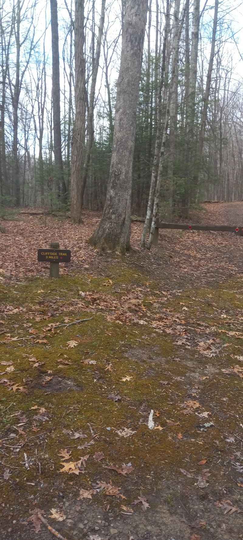
Cliffside Trail sits inside Twin Falls Resort State Park near Mullens and runs 3.5 miles. West Virginia State Parks rates it moderate to difficult, with rocky and strenuous terrain on the outer loop.
Opening stretches follow an easy ridge-top doubletrack. Wide footing makes conversation simple early on.
Then the route narrows into a singletrack loop with rougher terrain. Roots and loose stones demand a bit more focus.
Two cliff overlooks reward the effort, known locally as Buzzard Cliff and Canada Cliff. Valleys and rounded mountains stretch out below both.
Red blazes mark the way, so navigation stays straightforward. Junctions are signed clearly enough for first-timers.
Late spring fills the corridor with glossy rhododendron thickets. Fall drapes the ridges in crimson and butterscotch.
Songbirds are constant company, and deer tracks cross the path often. Rocky and root-filled sections demand attention, particularly as the trail becomes more strenuous around the outer loop.
Morning hikes tend to be cooler and quieter. Sunset works too, provided you carry a light.
The surrounding park adds a lodge, golf course, and other trails for a longer stay. Restrooms and parking are easy to find.
Access comes off Route 97 in Mullens, and these two quiet cliffs may end up your favorite southern West Virginia surprise.
9. Big Branch Trail, Hinton
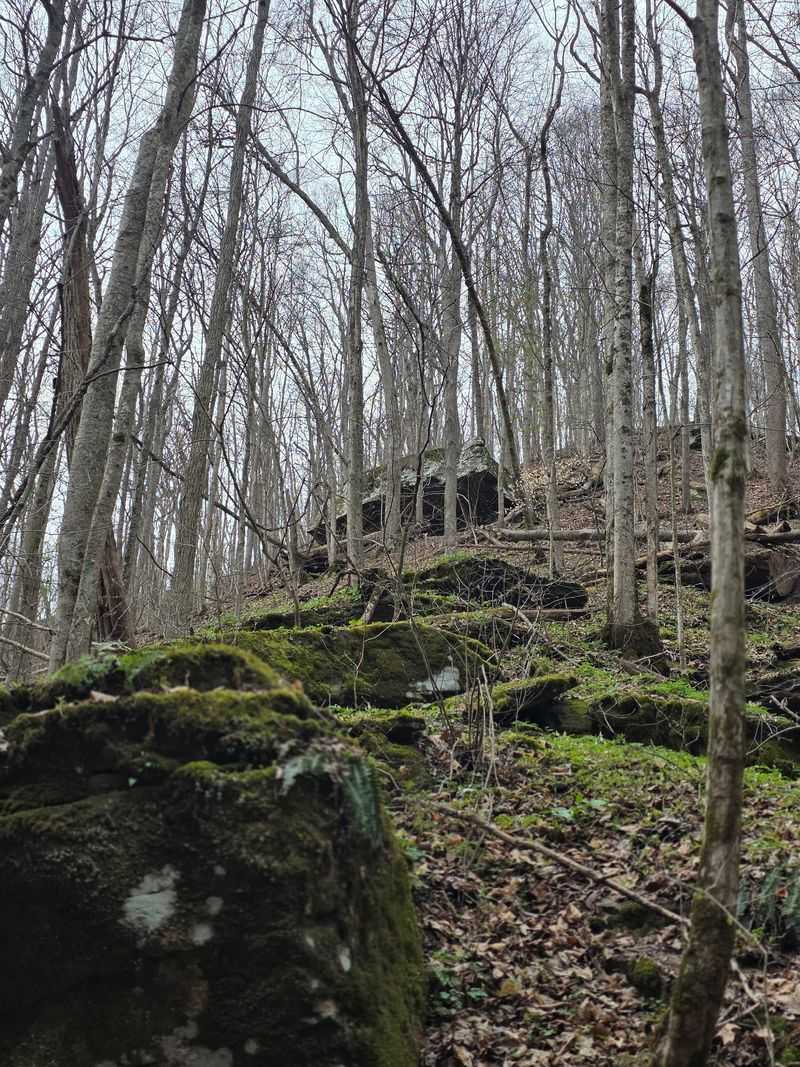
Several waterfalls and cascades line this strenuous two-mile loop, making spring an especially scenic time to tackle it.
Big Branch Trail near Hinton is rated strenuous by the National Park Service, though many find it closer to moderate. The loop measures about two miles.
Climbing begins moderately through woods carpeted in wildflowers. Early spring can bring trout lilies, spring beauties, toothwort, bloodroot, and other wildflowers along the trail.
The route follows Big Branch upstream past cascade after cascade. Big Branch Falls, dropping around 30 feet, is the headliner.
Tiered sandstone shapes the largest waterfall, where Big Branch plunges nearly 30 feet.
The trail crosses and follows Big Branch in places, making good hiking shoes especially useful around wet and rocky sections.
Higher on the ridge, gaps in the trees reveal the New River and Brooks Falls. Winter views are clearest once leaves drop.
You also pass stone ruins of an old highland farmhouse. Imagining daily life up here is oddly moving.
Flow is strongest after rain or during snowmelt, so time your trip accordingly. Late summer can slow the cascades to a trickle.
Rocky footing means slow, steady pacing beats speed. Insect repellent helps in warmer months.
Start from the Brooks Falls Roadside Park on River Road at Brooks Falls in Hinton, and count those cascades as you climb.
10. Castle Rock Trail, Beaver
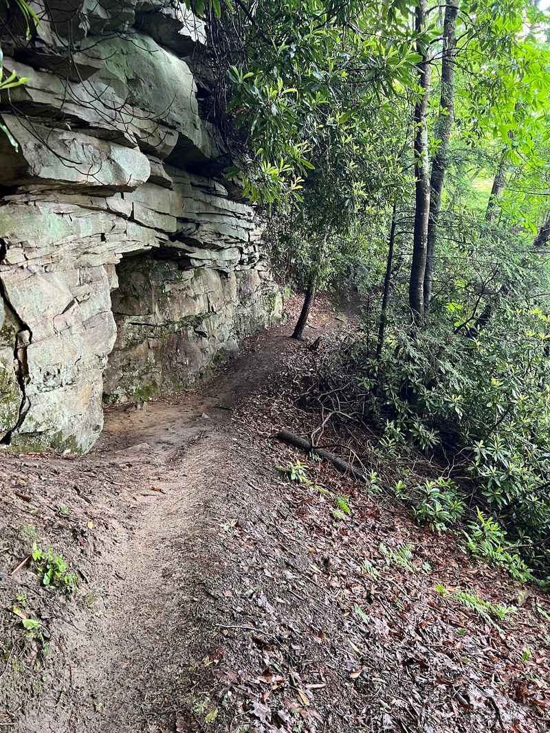
I’m still trying to wrap my head around rock walls that look built rather than eroded. Short does not mean simple on this one.
Castle Rock Trail runs 0.6 miles one way and is rated strenuous by the National Park Service. Linking it with Grandview Rim creates a roughly 1.1-mile loop back to the main area.
Steep grades and uneven footing arrive quickly. Sturdy boots with real tread are strongly advised.
The path drops below towering sandstone walls that resemble a fortress. Hence the name, and hence the constant urge to look up.
Exposed coal seams streak the rock in dark bands. That black stripe tells the story of the region’s mining heritage.
Drop-offs edge parts of the route, so keep children close and dogs leashed. Wet rock becomes slick fast.
Linking Castle Rock with Grandview Rim creates a roughly 1.1-mile loop, taking hikers beneath the fortress-like cliffs before returning along the rim.
Warmer months scatter wildflowers across the ledges and talus. Winter ice makes the descent genuinely tricky.
Castle Rock itself follows beneath towering rock walls and exposed coal seams, while the connected Grandview Rim Trail provides the major gorge viewpoints.
Carry water, since the climb back up warms you quickly. Allow more time than the mileage suggests.
Trailhead access is at 4700 Grandview Road in Beaver, where West Virginia’s wild side saves its rockiest handshake for last.