These Strange Forgotten Ruins In Georgia Are One Of The Biggest Hidden Secrets In The South
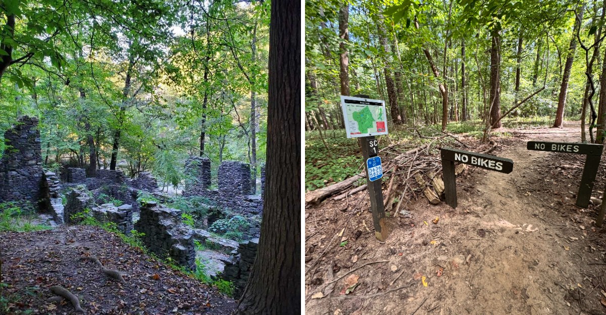
Nobody warned me what was waiting past the tree line. I parked on a gravel shoulder, half expecting a dead end and nothing else.
Instead I found stone walls rising out of the forest floor, crumbling but stubborn, like something built to outlast the people who made it. No plaque explained it.
No gift shop cashed in on it. Just moss, silence, and water running somewhere close by.
I stood there longer than I planned to, trying to guess who built this and why they left. Georgia holds onto its ghosts quietly, and this one has stayed hidden for longer than most.
A few locals know the story. Most visitors drive right past the turnoff without a clue.
I almost did too. Once you see ruins like these standing alone in a Georgia forest, you stop trusting maps and start trusting detours instead.
Stone Walls That Look Like A Woodland Castle
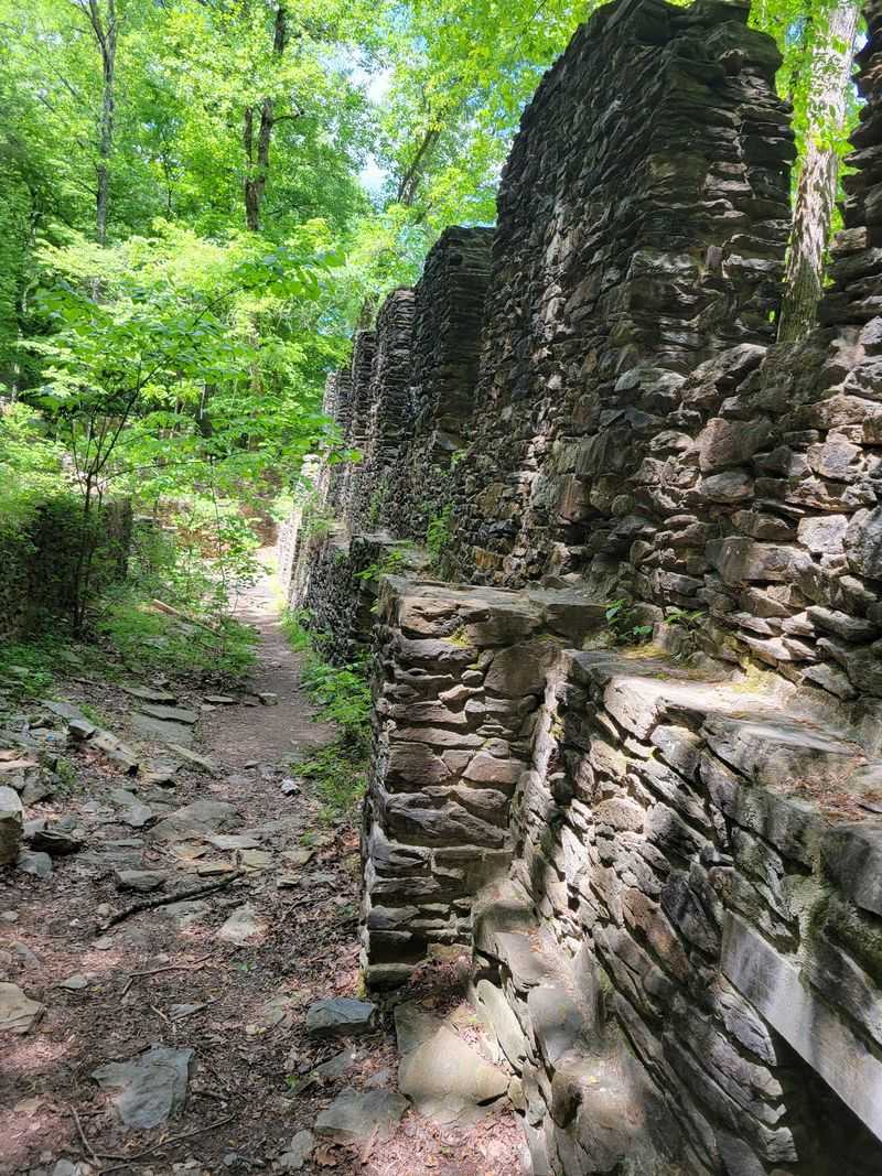
Nothing quite prepares you for stone arches rising out of a Georgia forest. The walls stand tall, roofless, with window openings framing nothing but leaves.
People often describe the structures as cathedral-like or castle-like, and that comparison fits. Ivy creeps along the masonry, and the rock has faded to a soft gray-brown color.
What surprised me most was the scale. These historic ruins stretch along Sope Creek, with stone structures visible on both sides of the water.
Some sections sit close to the roadway, which makes the first view almost accidental. You round a bend, glance left, and suddenly there is a nineteenth century industrial wall staring back.
Bring a camera, because morning light through the openings is genuinely beautiful. Deer sometimes graze inside the walls before the crowds arrive.
The stonework was laid by hand, without modern machinery. Look closely and you can still spot the seams where blocks were fitted together.
It feels strange to stand inside a building that stopped working over a century ago. Yet the walls are solid, quiet, and oddly welcoming at Sope Creek Paper Mill Ruins.
You will find the site along Paper Mill Rd SE, Marietta, GA 30067. Park access is also commonly listed near Brook Hollow Cir.
Cascades Tumbling Over Angular Boulders
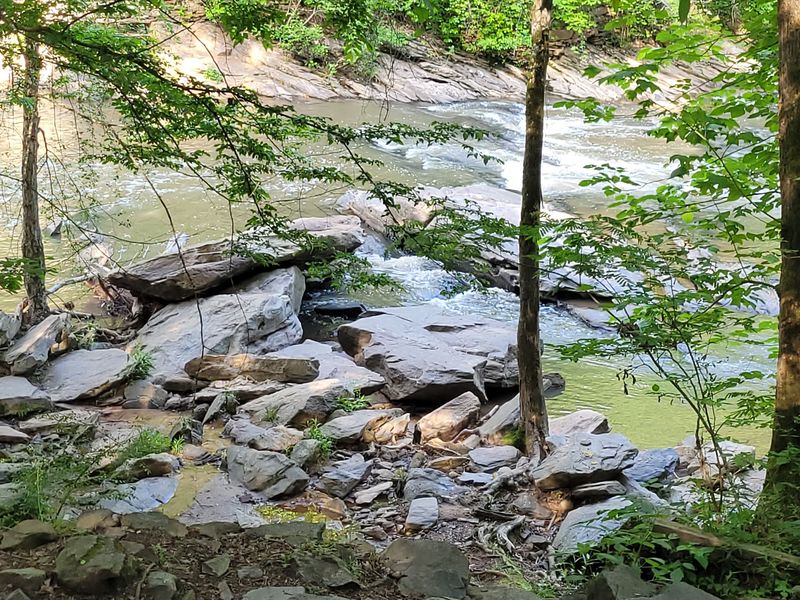
The sound reaches you before the view does. Water slides over blocky stone and breaks into small white cascades.
Sope Creek flows past the ruins across angular boulders, creating a natural staircase of rushing water. On warm days, families wade in the shallow edges.
Wildflowers grow along the banks, and leafy trees form a canopy overhead. In autumn the color reflects off the surface and doubles the effect.
Giant rocks along the water are perfect for sitting. I watched a group hop from boulder to boulder like it was a natural playground.
Footing can be slick where spray hits the stone, so slow down. Shoes with real grip beat sandals every single time.
The creek supplied the water power that ran the mill. Knowing that makes the current feel purposeful rather than random.
Photographers love late afternoon here, when light filters sideways through the trees. The contrast between moving water and still stone is striking.
Plan extra time near the water. Most visitors arrive for the ruins and end up staying for the creek.
Trails Built For Every Energy Level
You do not need hiking boots and a survival kit for this. A short walk gets you most of the reward.
An easy 1.5-mile loop visits the ruins and a peaceful pond. From the parking lot, the trip to the ruins and back runs roughly 1.25 miles.
Longer options exist for people who want mileage. Interconnected trails reach 6.6 miles, and linking to Cochran Shoals pushes it near 8.5 miles.
The path heads downhill toward the ruins, which means the return climb is the harder half. It is gentle, but pace yourself on hot days.
Tree roots cross the trail in several spots. Watch your feet rather than your phone screen.
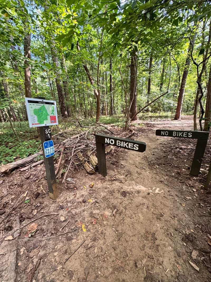
Mountain bikers share portions of the network, while hiking-only trails are marked with no-bike signs. Stay alert at trail crossings.
Wide forest paths make this workable for running, too. The surface is generally well maintained and clean.
Leashed dogs are welcome, and many splash happily near the pond. Keeping the leash on keeps everyone comfortable.
Sibley Pond, The Quiet Detour
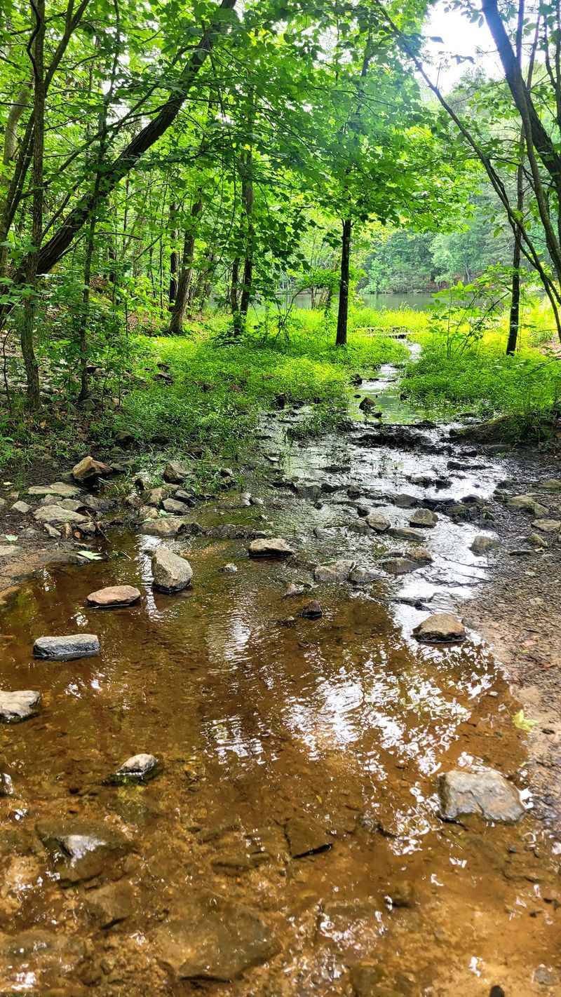
Most visitors rush toward the stone walls and skip the water in the middle. That is a mistake worth correcting.
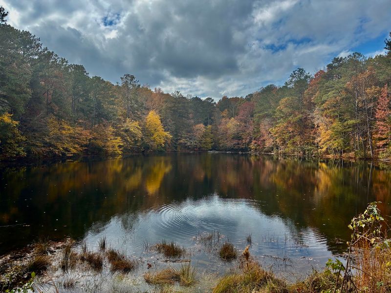
Sibley Pond sits along the easy loop, ringed by trees and reflections. The surface goes glassy on still mornings.
Dogs love wading at the shallow edge, and it is a favorite cooldown stop. One visitor watched a chocolate lab paddle around like it owned the place.
Picnic tables sit nearby, so a packed lunch works well here. Older grills remain on site, weathered and quiet.
Birds are active around the pond edges, especially early. Bring binoculars if that is your thing.
The pond makes a natural turnaround point for young kids. If little legs give out before the ruins, this spot still feels like a win.
Signage near the trails identifies creatures you might encounter. Reading it before you walk makes the woods more interesting.
Give yourself ten quiet minutes at the shoreline. The pond adds a calm counterweight to all that dramatic stonework.
Yes, The Hunger Games Filmed Here
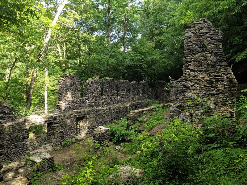
Movie fans, brace yourselves. These walls have screen credits.
The ruins served as a filming location for The Hunger Games: Mockingjay Part 1. Once you know that, the look makes perfect sense.
Broken stone, silent forest, water running through the middle. Hollywood did not need to build a set because the real thing already existed.
Standing inside the walls, the cinematic mood is obvious without any special effects. Sunlight breaks through gaps where a roof used to be.
It also explains why photos from here circulate online so often. The place photographs like a film still.
Fun detail for history lovers: a wooden covered bridge once crossed the creek nearby. It burned in 1964, and its original stone foundations remain visible under the modern bridge.
That mix of movie fame and genuine industrial history is unusual. Few places offer both in one short walk.
Look for the old foundations while you cross. Small details like that turn a hike into a scavenger hunt.
Ruins You Can Actually Walk Inside
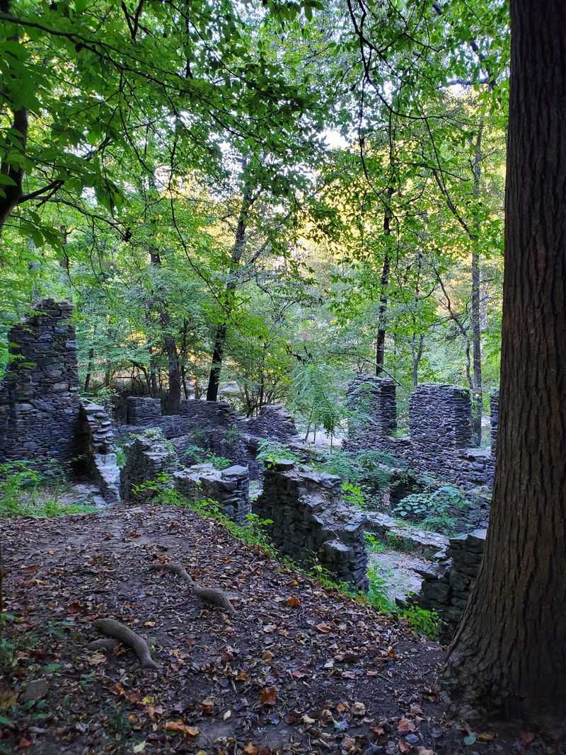
Plenty of historic sites keep you behind a rope. Visitors can view the surviving stone walls and openings while exploring the surrounding trails.
Some structures are easily accessible, and walking inside them feels almost unreal. The scale of the walls becomes obvious once you are surrounded.
A stone retaining wall supports parts of the trail. In certain sections, rock formations rise about twenty feet high.
Climbing on the surrounding rocks is popular with kids and adults alike. Steady footing matters, since old masonry is uneven by nature.
The Chattahoochee National Park Conservancy works on restoring the historic stonework. Projects address damage from weather, time, and unchecked plant growth.
Those efforts include stabilizing fragile walls and documenting current conditions. Preservation work is the reason future visitors will see the same view.
Treating the walls gently is the price of admission. Skip climbing on the delicate masonry and stick to solid ground.
The site joined the National Register of Historic Places on April 27, 1973. That listing helped protect what remains standing today.
Finding The Ruins Without Getting Turned Around
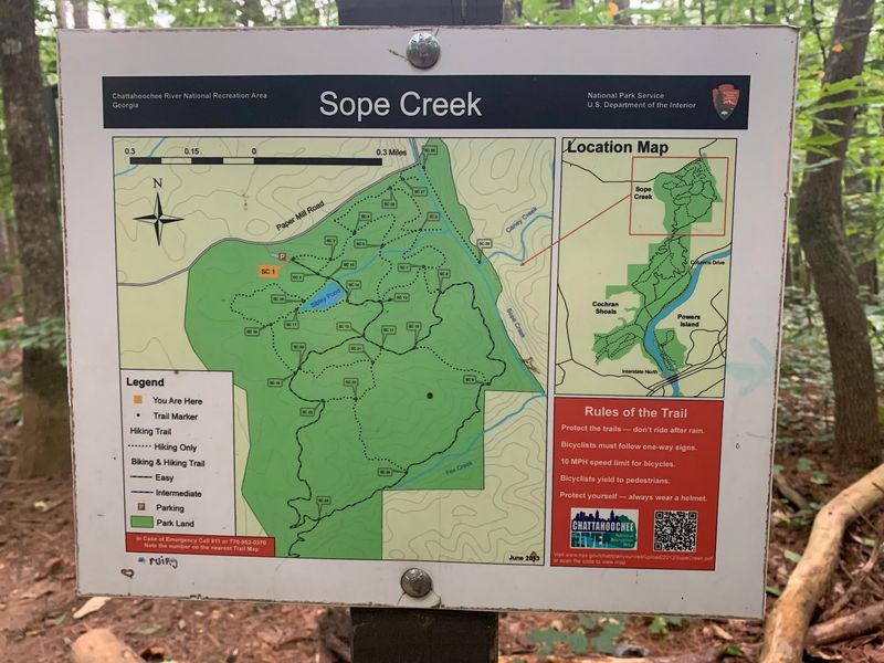
Here is the honest part. Plenty of visitors complete a loop and never find the ruins.
Signage has improved, and a better map now sits at the entrance. Still, a trail app helps enormously on a first visit.
The general trick is to stay toward the road side. Following that direction leads you to the walls.
Some of the ruins sit right along the roadway before the parking turn. If you glance while driving, you will spot stone through the trees.
Parking spaces are limited, and the lot entrance can be awkward. Arriving early solves both problems.
There are no restrooms on site, so plan accordingly before you arrive. That one detail catches families off guard.
Trail markers exist, but junctions can still confuse newcomers. Snap a photo of the entrance map before you start walking.
Wildlife shares the woods, including snakes in warmer months. Stay on the path, watch where you step, and you will be fine.
Practical Details Worth Knowing Before You Go
A little planning turns this into a smooth morning. Skip it and you may be hunting for parking change.
Access falls under the Sope Creek unit of the Chattahoochee River National Recreation Area, managed by the National Park Service. Parking requires a $5 daily fee or a $40 annual pass.
An America the Beautiful pass covers the fee as well. Keep it visible on the dashboard.
Park lands and waters are generally open from dawn to dusk, while vehicle gate hours can vary seasonally.
Weekends bring crowds, especially midday in spring and fall. Weekday visits feel almost private.
Bring water, since there are no facilities along the trails. Bug spray helps during summer, and so does patience with spiderwebs.