This Massive Northern California Lake Has An Entire Lost Town Hidden More Than 400 Feet Beneath The Water
A peaceful day on the water feels very different once you know an entire town is sitting somewhere far below the boat.
More than 400 feet beneath one massive lake lies the remains of a community that once had streets, businesses, and people going about ordinary daily life.
The landscape changed dramatically when a major dam project reshaped the area, leaving that earlier chapter underwater.
Northern California hides plenty of history, but very little of it requires looking hundreds of feet beneath a lake to find it.
Today, visitors can cruise, fish, or simply admire the enormous body of water without seeing much evidence of what disappeared below.
That contrast makes the story especially fascinating. A place built for modern recreation is also covering a very different world from decades ago.
Kennett Was Once A Bustling Copper-Mining Town
Long before boats cruised overhead, a busy town filled a narrow river canyon north of Redding.
Kennett grew up near the spot where Backbone Creek met the Sacramento River, in rugged hills rich with minerals. The land was first home to the Wintu people, who knew the area long before any miners arrived.
Gold was reported along Backbone Creek in the 1850s, but the real turning point came later.
During the early 1880s, the site served as a camp for crews building the railroad through the canyon. A permanent town took shape around 1884, and it kept growing as mining picked up nearby.
Estimates of the population vary quite a bit from source to source. Historical reporting describes a town with thousands of residents at its height, and some accounts put the peak as high as 10,000 during World War I.
For readers planning a trip, that background changes how the lake looks. Calm blue water near the dam sits over a place where families once raised children, worked long shifts, and built a real community.
The Town Had A Surprisingly Lively Downtown
Mining towns are often pictured as rough and bare, yet Kennett had plenty going on.
Stores, hotels, a school, and a hospital served the people who lived there. Everyday errands like buying supplies, mailing letters, and seeing a doctor could all happen right in town.
Social life seems to have been lively too. Historical accounts describe a saloon called the Diamond with a very long redwood bar and fancy chandeliers.
Details like that suggest a place with more polish than many people expect from a copper camp.
One general store opened in 1884 and became a key stop for miners. Over time, it also served as the post office and a polling place, and a hotel was later added.
Streets, sidewalks, and storefronts all sat where the deepest water near the dam now rests. People shopped, chatted with neighbors, and celebrated holidays in spaces that later vanished completely.
Visitors curious about daily life in old Shasta County mining towns can look for historical photos and exhibits in the region.
Shasta Dam Changed Everything
Big projects often start as ideas decades before the first shovel hits the ground.
Federal interest in damming the upper Sacramento River reached back to the late 1800s, and the plan gained momentum during the Great Depression. Work on the dam itself began in 1938 and continued into 1945.
Water storage started in February 1944, before construction was fully finished. From there, the reservoir rose gradually, filling canyons, creek valleys, and the old river corridor.
The change was not sudden like a flood. Residents and property owners had to leave before the water arrived, and some buildings were reportedly moved or torn down ahead of time.
By the time the lake spread out, the town had already gone quiet.
For the region, the dam brought flood control, water supply, and electricity. For the people of Kennett, it meant packing up and starting over somewhere else.
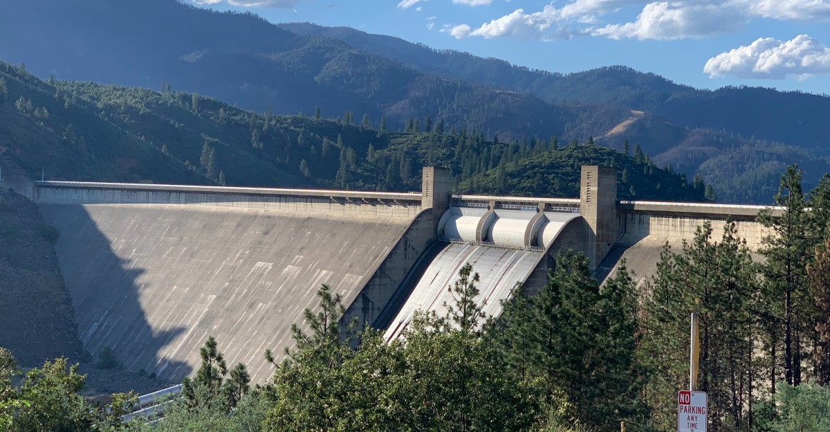
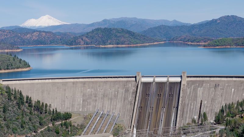
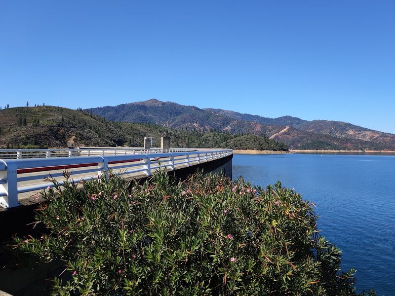
Visitors today see the result as a wide lake framed by forested hills and a massive concrete wall. Standing near the dam offers a clear sense of how much the landscape shifted in just a few years.
Kennett Ended Up More Than 400 Feet Underwater
Four hundred feet is hard to grasp until it is compared to something familiar. That depth is longer than a football field stood on end.
Historical reporting places the old town beneath more than 400 feet of water when the lake is full.
The town sat in the Sacramento River canyon, one of the lowest spots in the area before the reservoir existed. Now it rests in one of the deepest parts of the lake, just upstream from the dam.
Depth changes along with the lake level. When the reservoir drops in dry years, the water above Kennett gets shallower, but it still stays far above the old streets.
Scuba divers sometimes wonder about exploring the site, but the depth puts it well beyond normal recreational limits.
Cold, dark water at that level adds even more risk. The safest way to experience Kennett is through photos, maps, and history rather than a dive.
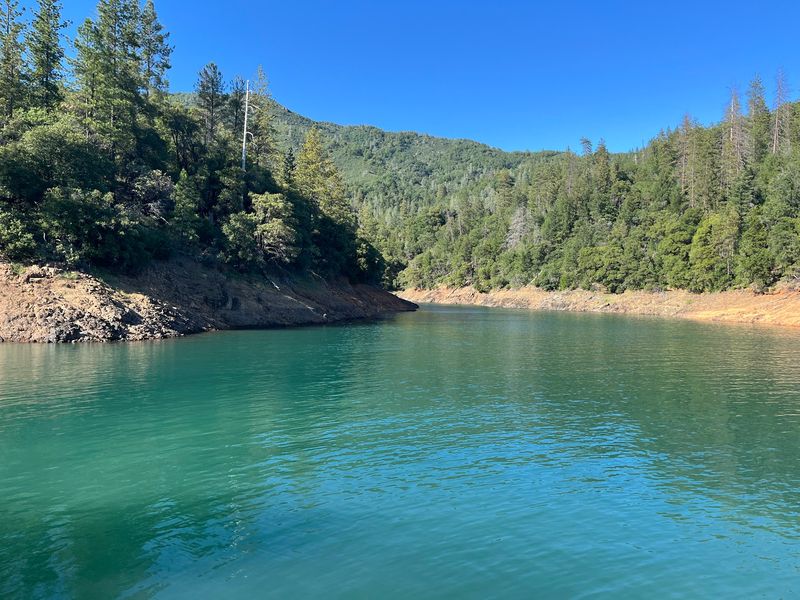
Out on the water, a boat ride over the deep section near the dam can feel peaceful. The surface looks like any other stretch of lake, with gentle ripples and wide views of the hills.
Kennett Wasn’t The Only Community Changed By The Reservoir
Losing one town is dramatic, but the lake reshaped far more than a single spot on the map. Homesteads, ranches, and private properties sat along the rivers and creeks that would later fill with water.
Federal records note that land was purchased ahead of the flooding during the late 1930s.
Native allotments were part of those purchases too. The Wintu people had lived along the upper Sacramento River and nearby waterways for generations, and the reservoir covered places connected to them.
Families who left had to find new homes, jobs, and routines. Some moved to nearby towns, while others left the region altogether.
Churches, schools, and cemeteries also had to be dealt with, and some graves were relocated before the water rose at this California area.
For visitors, that wider view adds depth to a trip. The lake draws house boaters, anglers, and swimmers, and all of that fun sits on top of a layered past.
Respect for the area goes a long way. Leaving any artifacts found along the shore exactly where they are helps protect history for others, and federal land rules generally prohibit removing them.
A Giant Construction Tower Sometimes Rises From The Lake
Here is one of the oddest sights the lake can offer, and it has nothing to do with Kennett.
During dam construction, crews relied on an enormous head tower that helped run a cableway system for moving materials.
Remains of that tower begin to appear when the reservoir drops roughly 90 feet below the top of the dam.
The cableway system was a clever solution. Cables stretched from the tower across the canyon, carrying buckets of concrete and heavy equipment to where workers needed them.
The setup helped crews keep materials moving steadily during the busiest phases of work.
When the job was done, not every piece of the tower was hauled away. Parts of the structure stayed behind and were eventually covered by the rising lake.
Now it acts almost like a giant water-level gauge.
Seeing the tower poke above the surface usually signals a low year. Locals and regular visitors often treat it as a sign of how dry the season has been.
The best views generally come from the water near the dam or from viewpoints along the shore when conditions allow.
Shasta Dam Is 602 Feet High
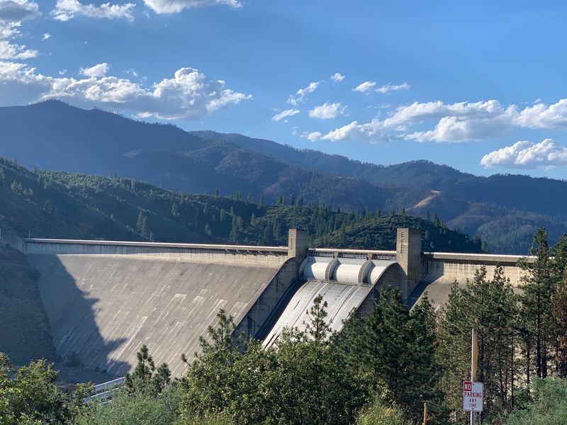
Numbers alone cannot capture how huge the dam feels in person, but they definitely help.
The structure rises 602 feet and stretches 3,460 feet across the Sacramento River. It holds roughly 15 million tons of concrete, a figure that almost seems unreal.
For comparison, 3,460 feet is longer than half a mile. Walking that distance would take several minutes at a relaxed, easy pace.
Looking down from the top, the river below can appear small and far away.
The dam is a curved gravity design, meaning its sheer weight helps hold back the water.
Its massive size explains how an entire canyon, town, and river corridor could disappear behind it. Once the gates held back the flow, the landscape upstream changed for good.
Few projects of its era matched it for size and ambition. Its spillway is also striking, running down the face of the dam in a long concrete chute.
During very wet years, heavy spillway releases can create a loud, misty scene worth seeing.
Views from the visitor center area and nearby overlooks show off the dam and, on clear days, the snowy peak of Mount Shasta in the distance.
The Lake Is Enormous
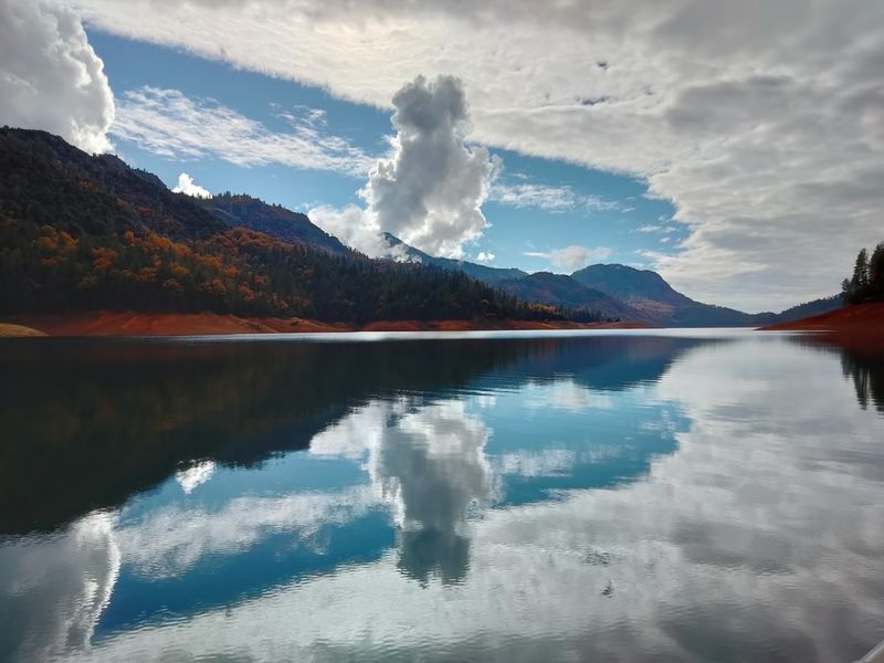
Big is an understatement when it comes to this reservoir. Total storage capacity sits at roughly 4.55 million acre-feet, making it the largest reservoir in California.
The National Park Service describes about 365 miles of shoreline, close to the driving distance between San Francisco and Los Angeles.
An acre-foot is the amount of water needed to cover one acre about one foot deep. That volume fills several major river arms, including the Sacramento, McCloud, and Pit.
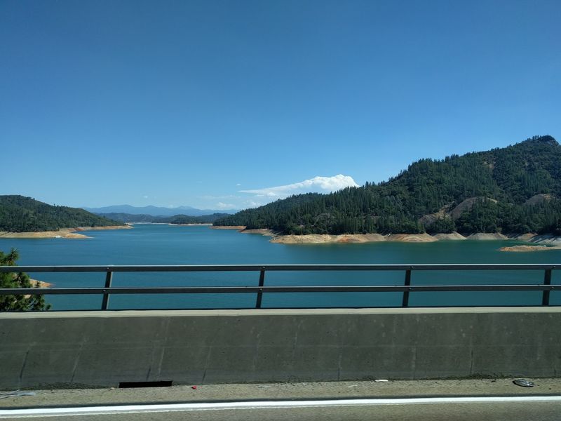
All that shoreline creates countless quiet coves, rocky points, and tree-lined inlets. Houseboats are a popular way to explore, and marinas around the lake rent them along with smaller boats.
Spending a few nights on the water allows for a slower, more relaxed pace than a quick day trip.
Land-based visitors have options too. Campgrounds, picnic areas, and trails sit around parts of the shoreline, many managed within the Shasta-Trinity National Forest.
Summer tends to bring the biggest crowds, while spring and fall often feel calmer and cooler.
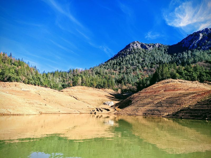
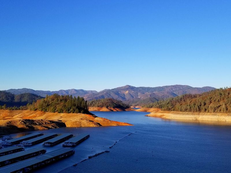
Water levels change a lot through the year, which affects how the lake looks. A full lake in spring can look deep green and blue right up to the tree line, while late summer often shows a wide band of red soil along the edges.