9 California Hiking Trails Where Rattlesnakes Can Still Appear In November
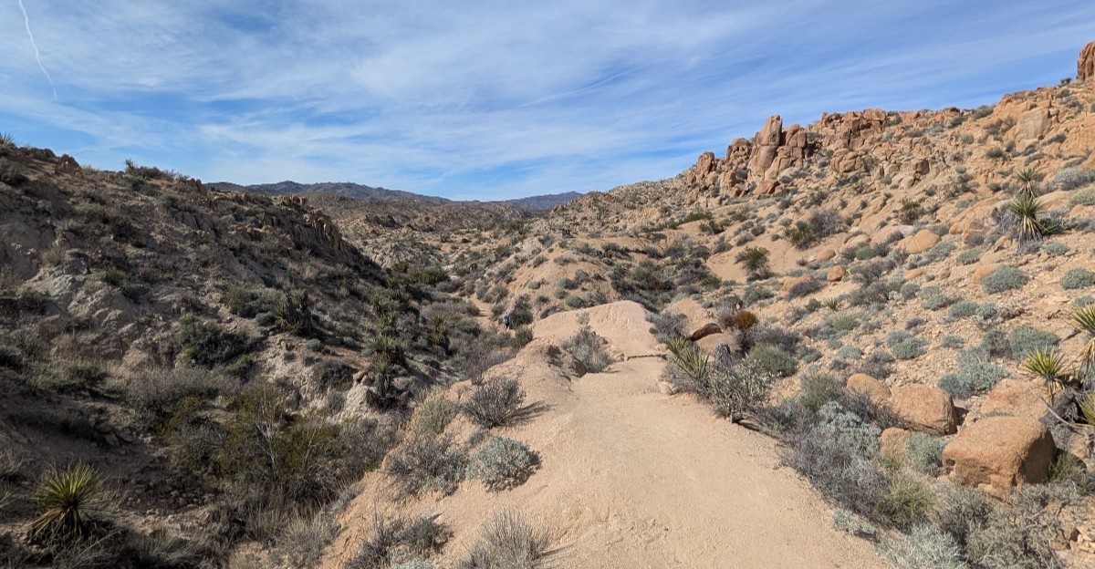
A rattlesnake doesn’t care what month it is. It cares how warm the rocks are, and in the desert, a sunny November afternoon can feel downright toasty.
Rattlesnakes are cold-blooded, so they lean on sunshine to stay active. When fall days heat up, some of them slide out to bask on trails, ledges, and boulders.
That surprises plenty of hikers who assume snake season packed up with summer.
I love hiking in California once the brutal heat fades. The light gets softer, the crowds feel calmer, and the views stay huge.
Still, I can’t stop thinking about how a cool morning can turn into a snake-friendly afternoon by lunchtime.
Which trails deserve a little extra attention this time of year? The list below mixes palm oases, granite boulders, grassy hills, and desert peaks.
Each one is worth hiking, as long as you watch where your boots land.
1. Borrego Palm Canyon Trail
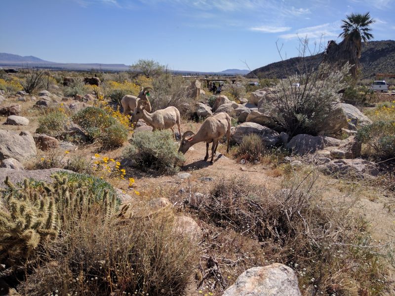
Palm trees in a bone-dry desert canyon sound like a mirage. Yet this path leads toward one of California’s most notable native palm oases.
The trail runs about 3 miles round trip with roughly 700 feet of climbing. Rocky ground, cactus, and ocotillo line much of the way, which gives snakes plenty of sunny hangouts.
Here’s an update you need before you go. The trail is open to an overlook, but the palm grove itself is closed until further notice due to fire damage.
A human-caused fire hit the grove in January 2020. So plan on enjoying the view from above rather than strolling under the fronds.
November afternoons in Borrego Springs can still warm the rocks nicely. Keep your eyes on the trail ahead and avoid stepping over boulders you can’t see behind.
Hands matter too. If you grab a rock for balance, glance at it first, because a basking rattler won’t appreciate a surprise handshake.
The scenery makes the caution worth it. Lucky hikers sometimes spot rare Peninsular bighorn sheep picking their way across the canyon walls.
Fun fact for the drive home: the park’s name honors explorer Juan Bautista de Anza. The other half comes from borrego, the Spanish word for bighorn sheep.
Dogs are not allowed on this trail, so leave your pup with a sitter. The visitor center nearby opens daily from October through May, which makes it handy for questions.
Address: Borrego Palm Canyon Campground, Anza-Borrego Desert State Park, Borrego Springs, CA 92004
2. The Slot Trail
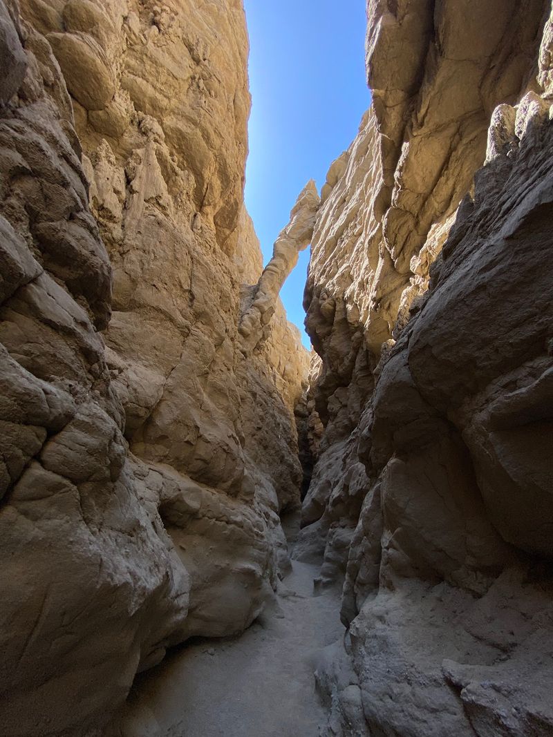
Squeezing through a canyon barely wider than your shoulders feels like a desert adventure movie. The good news is you don’t need a stunt double.
This short route sits in the Buttes Pass area of Anza-Borrego Desert State Park. That park is the largest state park in California, so you’re hiking in very roomy company.
The star attraction is the narrow slot canyon itself. Tall, twisting walls close in around you, then open up again as the wash widens.
Tight spaces call for a smart snake strategy. Shady ledges and cracks can hide a resting rattler, especially when the sun heats the open ground.
Look before you reach into any crevice. Step onto rocks rather than over them, so you can see what’s on the other side.
Slow down at blind corners too. Giving a snake a few extra seconds of warning usually means it’ll choose to scoot away from you.
History buffs, take note. Archaeological findings show people were active in the Anza-Borrego area about 6,000 years ago.
The trail is generally open from an hour before sunrise to an hour after sunset. A day-use fee applies per car, so plan for that at the start.
Bring more water than you think you need, even in November. Desert sun doesn’t read the calendar, and neither do the rattlesnakes.
Address: Buttes Pass Area, Anza-Borrego Desert State Park, Borrego Springs, CA 92004
3. Barker Dam Nature Trail
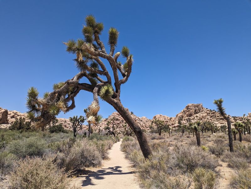
Cattlemen built a dam in the middle of the desert back in 1900. That bold idea left behind one of the most charming short hikes in Joshua Tree National Park.
The loop measures roughly 1.1 to 1.3 miles. It’s easy on the legs, which makes it a favorite for families and first-time desert visitors.
Giant monzogranite boulders stack up along the route. Iconic Joshua trees pose nearby like they’re waiting for their close-up.
Barker Dam was later raised in 1949 by rancher William F. Keys. Today the structure is listed on the National Register of Historic Places.
After big rains, the reservoir sometimes holds water. Water attracts wildlife, and rattlesnakes follow the critters they like to snack on.
So keep kids on the trail and close by. Boulders make tempting climbing gyms, but they also make cozy snake shelters on a sunny fall day.
A short distance west of the dam, you can view Native American petroglyphs. Admire them with your eyes only, and watch the ground near the rock base.
Pets are not permitted on this trail. That’s honestly a relief, since curious dogs and rattlesnakes are a terrible combination.
Park day-use hours generally run sunrise to sunset. November mornings start chilly, so the snakes often show up later, once the boulders soak up the sun.
Address: Barker Dam Road, Joshua Tree National Park, Twentynine Palms, CA 92277
4. Hidden Valley Nature Trail
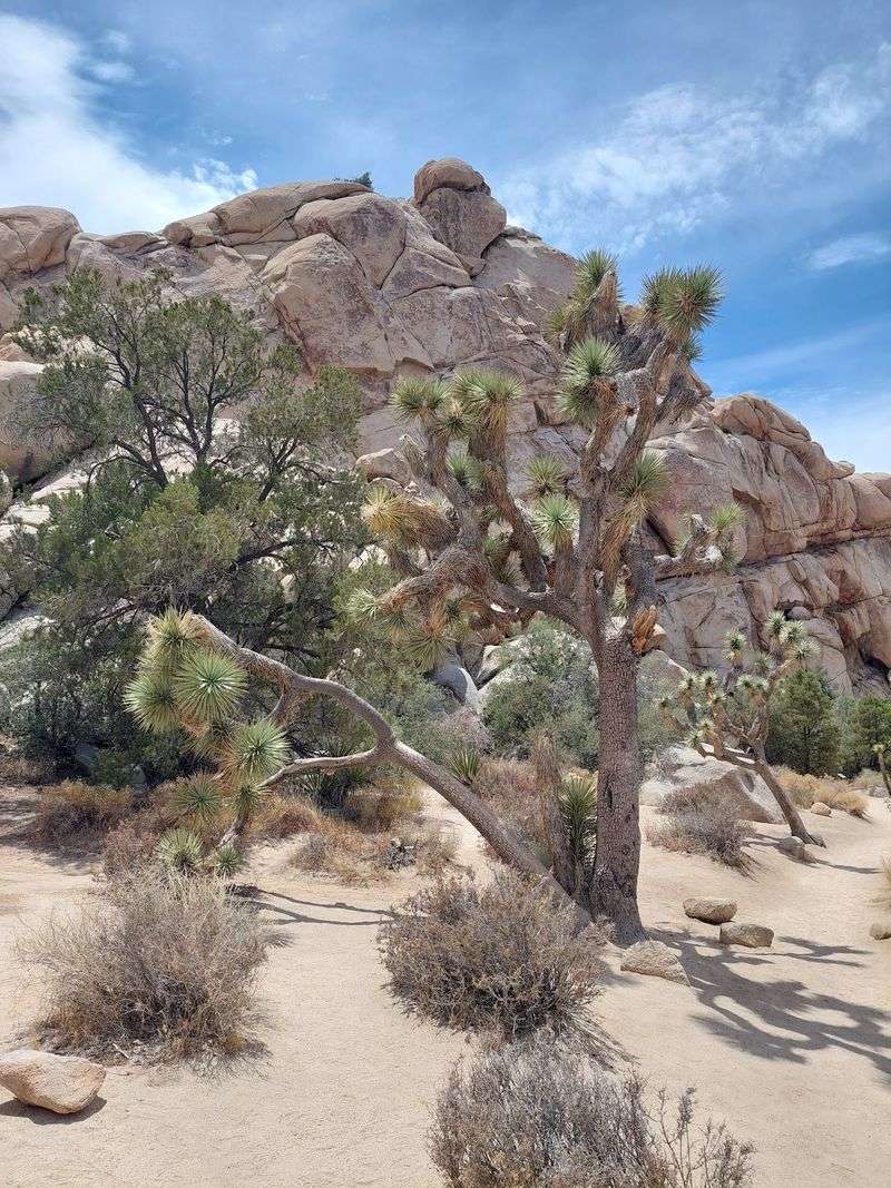
Legend says cattle rustlers once stashed stolen livestock here. With walls of rock wrapping around the valley, you can see why the rumor stuck.
Hidden Valley Nature Trail is an easy one-mile loop. It sits off Park Boulevard, between the West Entrance and the Barker Dam Road intersection.
The natural rock enclosure creates a sheltered pocket of desert life. Plants grow thicker here, and wildlife enjoys the protection from wind.
Snakes enjoy it too. Sheltered spots warm up nicely on a bright November afternoon, which can coax a rattler out to sunbathe.
Climbers and boulderers love this area. If you scramble off the path, check ledges and cracks before you put your fingers anywhere.
Your ears are a great safety tool. Skip the earbuds so you can hear a buzzing rattle if one sounds off nearby.
Should you hear that unmistakable sound, freeze and locate the snake. Then back away slowly, giving it plenty of room to relax.
The loop is short enough for little hikers. Teach them early that a snake is something to admire from far away, not poke with a stick.
Golden afternoon light here makes the rock walls glow, so pack your camera along with your caution.
Address: Hidden Valley Nature Trail Parking Area, Park Boulevard, Joshua Tree National Park, Twentynine Palms, CA 92277
5. Ryan Mountain Trail
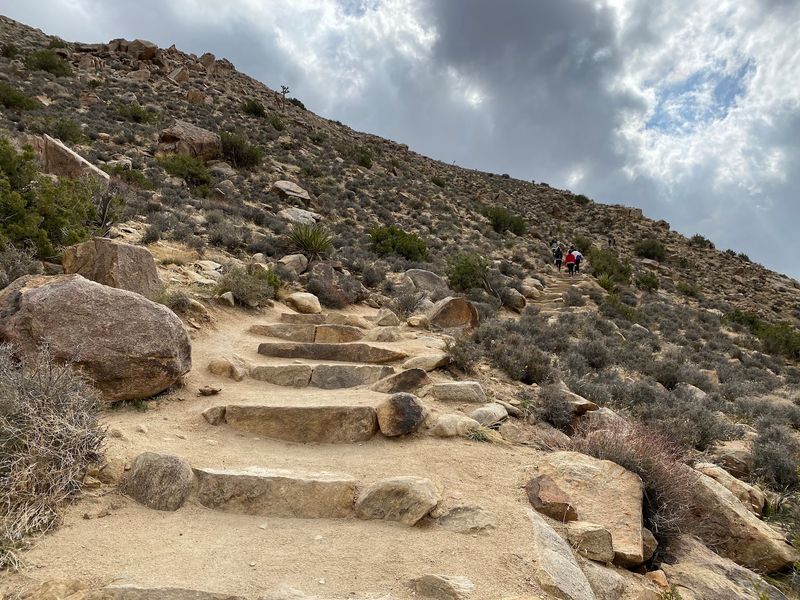
Want the whole park in one glance? Ryan Mountain hands you a 360-degree view from a summit perched at 5,461 feet.
Earning that view takes some effort. The trail climbs about 1,000 feet over a 3-mile round trip, and your calves will notice.
Joshua trees and dramatic rock formations keep you company on the way up. Stone steps and rocky stretches give the route a rugged personality.
Here’s why snakes belong in this conversation. Rocky, sun-facing slopes heat up quickly, even when the air feels crisp at the trailhead.
When you stop to catch your breath, pick your seat wisely. A flat rock might already be occupied by a sunbathing rattlesnake.
Use trekking poles if you have them. They help on the climb, and they let you stay steady without grabbing random rocks.
Pace yourself on the descent too. Tired legs lead to sloppy footing, and that’s when hikers stop watching the trail ahead.
The trailhead sits off Park Boulevard near Ryan Campground. Arrive early on November weekends, since this hike is a popular choice.
Up top, take your time and soak in the views. Then remember that the snakes below don’t care how many summit selfies you snapped.
Address: Ryan Mountain Trailhead, Park Boulevard, Joshua Tree National Park, Twentynine Palms, CA 92277
6. Telegraph Canyon Trail
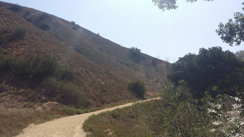
Rattlesnakes aren’t only a desert story. Rolling grassy hills in Chino Hills State Park give them plenty of room to roam too.
Telegraph Canyon Trail winds through valleys dotted with oak and sycamore trees. Hikers, bikers, and horseback riders share the path.
The park covers more than 14,000 acres of preserved wilderness. It was established in 1981 and protects a key link in the Chino-Puente Hills wildlife corridor.
Wildlife corridors mean wildlife, plain and simple. Rodents scurry through the grass, and rattlesnakes happily follow their lunch.
Tall grass along the edges hides a lot. Stick to the middle of the trail, where you can see the ground clearly.
Sharing with bikes adds another twist. Stay alert for wheels, and give riders a heads-up if you spot a snake stretched across the dirt.
Winter hours start in November, running from 8 a.m. to 5 p.m. That shorter window keeps you hiking during the warmest part of the day.
Warm hours equal snake hours, so keep your guard up. Sunny afternoons after a cool morning are prime basking time.
The park may close temporarily during heavy rain or extreme fire danger. Check conditions before you lace up, especially after a storm.
Address: 4721 Sapphire Rd, Chino Hills, CA 91709
7. Saddleback Butte Peak Trail
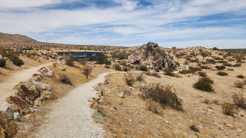
Here’s a park that once shared a name with a famous neighbor. It started as Joshua Tree State Park, then switched names to avoid confusion with Joshua Tree National Monument.
Saddleback Butte State Park was created in 1960 to protect the butte and its Joshua tree woodlands. The butte itself dates back roughly 70 million years.
The Peak Trail is a challenging climb to a 3,651-foot summit. Your reward is a sweeping view over the Antelope Valley and the Mojave Desert.
Park staff specifically warn hikers to watch for rattlesnakes here. Sidewinders and Mojave green rattlesnakes are active in warm weather.
That warning matters on warm fall days. Steep, rocky sections invite you to grab handholds, so look first every single time.
Other wildlife makes appearances too. Jackrabbits, coyotes, lizards, and desert birds are common, and you might spot a desert tortoise or kit fox.
Dogs aren’t permitted on the trails. Leave Fido at home and bring a hiking buddy who can carry extra water.
The day-use picnic area opens daily from 9 a.m. to 5 p.m. On weekends, the visitor center welcomes guests from 11 a.m. to 5 p.m.
Start early to beat the heat on the climb. You’ll also be heading down before the afternoon rocks get toasty enough for basking snakes.
Address: 17102 East Avenue J, Lancaster, CA 93535
8. Mastodon Peak Loop Trail
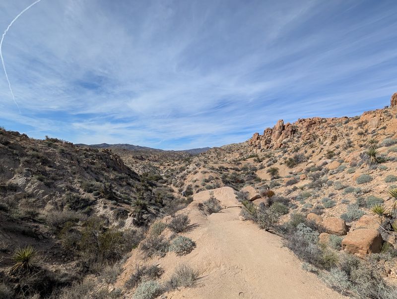
Gold fever once struck this corner of the desert. The ruins of the old Mastodon Mine still sit along the loop, a reminder of the park’s mining days.
The route starts at Cottonwood Spring in the southern part of Joshua Tree National Park. A natural palm oasis grows at the spring, which has long drawn people and wildlife.
Plan on a moderate loop of about 3 miles. Some rock scrambling near the peak adds a little spice to the outing.
Scrambling is exactly where snake awareness pays off. Before you place a hand on a ledge, take a quick peek at what’s there.
From the top, the Eagle Mountains spread across the horizon. It’s a fantastic payoff for a fairly short hike.
Mine ruins deserve respect too. Stay out of old structures and holes, since snakes and other critters may shelter inside.
The oasis area tends to buzz with life. Where birds and rodents gather, a rattlesnake might be quietly waiting nearby.
Hiking poles help on the rocky sections. They can also gently tap the trail ahead, giving any hidden reptile a polite heads-up.
Finish your loop with daylight to spare, since spotting snakes gets harder as light fades.
Address: Cottonwood Spring Trailhead, Joshua Tree National Park, 74485 National Park Dr, Twentynine Palms, CA 92277
9. Palm Canyon Trail
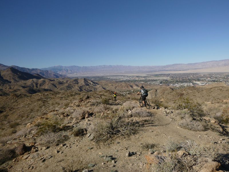
More than 2,500 mature palms crowd into a single canyon here. It’s one of the world’s largest natural California fan palm oases, and it looks unreal in person.
Indian Canyons is the ancestral homeland of the Agua Caliente Band of Cahuilla Indians. The tribe owns and operates the area, and their ancestors once farmed using the creek’s water.
Palm Canyon is often called the crown jewel of Indian Canyons. A stream flows through the canyon, bringing green life to the dry surroundings.
Of course, a lush oasis also attracts animals. Rattlesnakes may slip through the brush near the water or rest on warm rocks above.
Trail lengths range from half a mile to 15 miles. That means you can pick a short stroll or a full-day trek.
Longer hikes take you farther from help. Carry a phone, tell someone your plan, and keep a steady eye on the path.
Want local expertise? Ranger-led interpretive hikes run Friday through Sunday from October through June.
No animals are allowed on the trail. The Trading Post offers refreshments plus Native American arts and artifacts when you finish.
From October through early July, the canyon opens daily from 8 a.m. to 5 p.m. Last vehicle entry is at 4 p.m., so don’t cut it close.
Address: Indian Canyons Toll Gate, 38520 S. Palm Canyon Dr., Palm Springs, CA 92264