Before Highways Crossed It, Nebraska’s Trail Was A Rail Line And Now Runs 195 Miles For Walkers
A quarter-mile railroad bridge stands about 148 feet above a river, and nobody drives a train across it anymore. Walkers and bikers do.
That bridge is one piece of a former rail line in Nebraska that now runs 195 miles with no cars allowed. The old tracks are gone, but the route still follows the same path trains took more than a century ago.
It links dozens of small towns spaced roughly 10 to 15 miles apart.
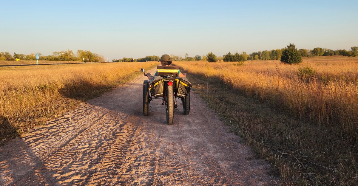
I like how the whole thing feels like a giant hallway through the state. You can walk a single afternoon stretch or plan a multi-day trip.
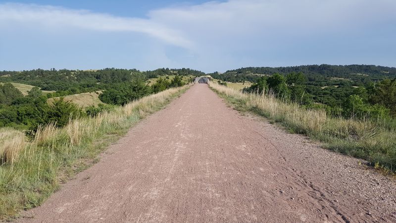
The surface is crushed gravel or limestone, and more than 200 bridges carry you over creeks and ravines.
So how did a forgotten railroad turn into one of the longest trails in the country?
An Old Rail Corridor That Swapped Trains For Walking Shoes
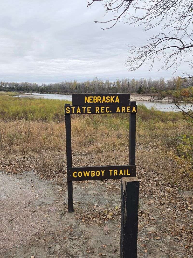
The Cowboy Recreation and Nature Trail, better known as the Cowboy Trail, runs 195 miles across northern Nebraska. Its main stretch connects Norfolk in the east to Valentine in the north-central part of the state.
Every mile follows a former railroad bed, so the grades stay gentle and the path stays steady. Trains needed easy slopes, and walkers get to enjoy that leftover engineering today.
Nebraska Game and Parks manages the trail, and motorized vehicles aren’t allowed anywhere on it. That means the only engines you’ll hear are tractors working nearby fields.
It’s a quiet route by design.
The trail welcomes walkers, bikers and horseback riders alike. Riders get a mowed path alongside the main surface, which keeps hooves and tires from crowding each other.
Winter doesn’t shut things down either. Snowshoeing, cross-country skiing and even dog sledding happen on certain sections when snow cooperates.
Hours run from a half-hour before sunrise to a half-hour after sunset. That gives early risers and evening strollers plenty of room to work with.
Few Nebraska outings stretch this far while staying this simple to start.
How The Cowboy Line Earned Its Second Life
Back in the late 1870s and early 1880s, the Fremont, Elkhorn and Missouri Valley Railroad laid this line westward. It served farms and pushed rail service deeper into Nebraska.
The Chicago and North Western Railway later ran the route, nicknamed the Cowboy Line. Cattle country and rail freight made a natural pair for decades.
Then trucks and highways changed everything. The section east of Norfolk was abandoned in 1982, and the stretch west of Norfolk followed in 1992.
That could have been the end of the story. Instead, the Rails-to-Trails Conservancy bought the corridor in 1993 and donated it to the state.
Nebraska lawmakers passed a bill that same year, which made the Cowboy Trail name official. The state formally accepted the donation on December 5, 1994.
Building out the full main stretch took time, and it wrapped up around 2008 and 2009. A lot of patient work went into turning old ties into a usable path.
What I love is how the history isn’t hidden. You walk the exact grade those trains once rolled across.
A Bridge 148 Feet Over The Niobrara That Steals The Show
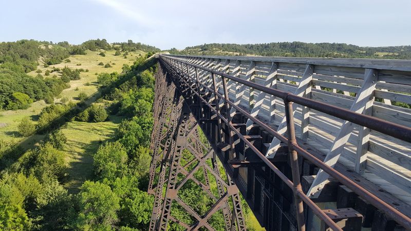
Ask anyone which spot to see first, and the answer points west. Near Valentine, a historic railroad trestle crosses the Niobrara River for about a quarter mile.
The deck sits roughly 148 to 150 feet above the water. Those numbers mean real views of the river valley spreading out in every direction.
The Niobrara holds a National Scenic River designation, so the scenery earns its reputation honestly. Standing up there, the valley looks carved and green against the surrounding hills.
Valentine also makes the bridge easier to reach. An electric bike rental station there helps folks who’d rather not pedal the whole way out on their own power.
Plan with the surface in mind, though. The stretch between Valentine and Johnstown can carry loose sand and gravel, which slows bikes down.
Wider tires help a lot on that section. Hybrid or mountain bikes handle it better than skinny road tires.
Honestly, I can’t imagine making the trip west without crossing it. It’s the kind of landmark that makes a Nebraska day trip feel bigger than the drive.
More Than 200 Bridges Keep The Rhythm Going
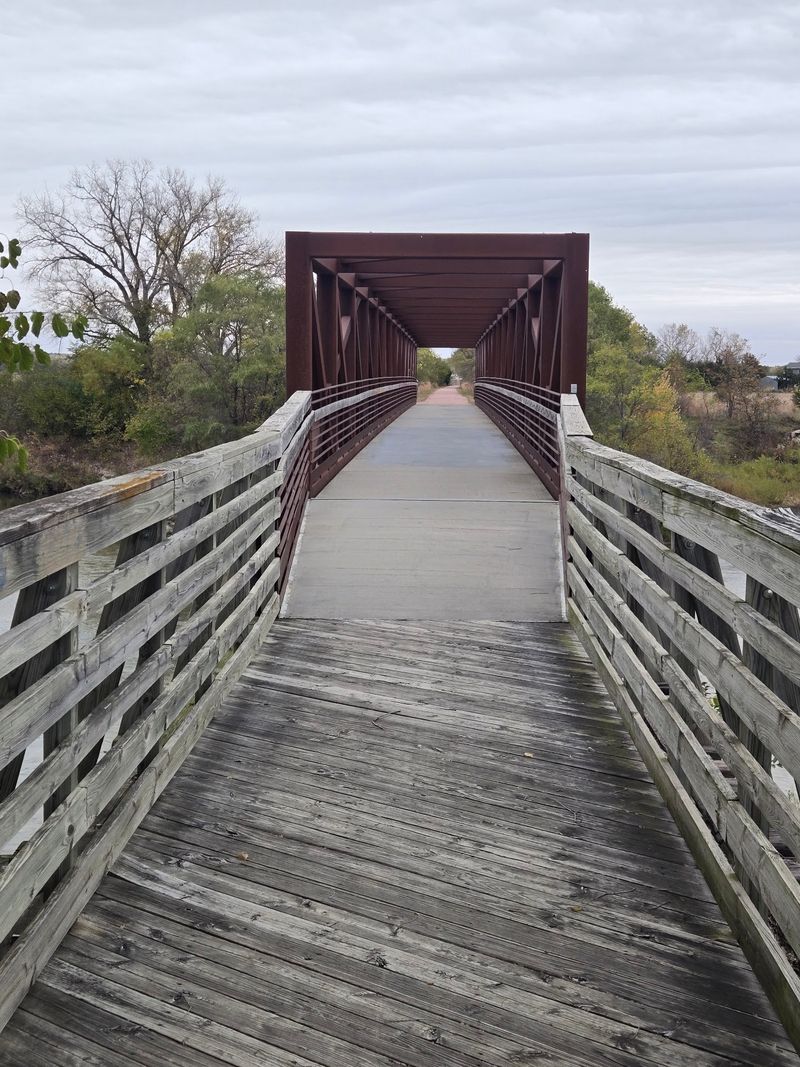
Count them if you dare, because the total tops 200. Bridges show up again and again along the Cowboy Trail, each one a leftover from its railroad days.
Most carry wooden decks over creeks, ravines and low spots in the land. The sound under your feet changes when you hit one, and that little shift becomes part of the trip.
The Niobrara trestle gets the glory. Still, these smaller crossings do the steady work of stitching the route together mile after mile.
Railroads built bridges because trains couldn’t dip into every gully. Walkers inherit that level path, which makes long distances feel far more manageable.
Families with younger kids may find the bridges make handy goals. Walking to the next creek crossing sounds a lot more fun than walking another mile.
Bikers will notice the bridges too. Slowing down on the deck gives you a moment to look around instead of staring at gravel.
No other Nebraska trail quite matches this collection. It’s a moving museum of rail engineering, and admission is simply showing up.
Prairie, Sandhills And River Valleys In One Long Line
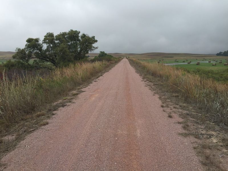
Few paths can claim four distinct ecoregions. The Cowboy Trail passes through tallgrass, mixed-grass and shortgrass prairie as it heads west.
Out east, the route follows the Elkhorn River Valley. Farmsteads, cropland and tree-lined riverbanks fill that stretch with a classic rural look.
Things shift as you move toward Valentine. The trail reaches into the Nebraska Sandhills, the largest grass-covered dunes in the Western Hemisphere.
That’s a big claim for a state many folks call flat. Rolling, grassy hills prove otherwise and surprise plenty of first-timers.
Near the western end, the Niobrara River valley adds another landscape entirely. The trail goes from field views to canyon-like scenery in a single region.
Watching the grasses change underfoot is half the fun. Shorter plants and drier ground slowly replace the taller prairie you started with.
The east end near Norfolk is very flat and smooth. That makes it an easy starting point if you want gentle miles before tackling the sandier west.
Pick your scenery, then pick your section.
Small Towns Every 10 To 15 Miles Make Great Pit Stops
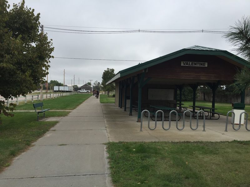
Running out of snacks is hard to do here. Roughly 29 to 30 communities sit along the Cowboy Trail, usually 10 to 15 miles apart.
Restrooms and drinking fountains aren’t typically on the trail itself. Town parks and local businesses fill that gap, so plan your breaks around the towns.
O’Neill stands out for its Old Historic Railroad Depot. It’s listed on the National Register of Historic Places and serves as a trailhead with public restrooms and water.
Near Neligh, the Neligh Mill State Historic Site sits just off the route. It’s an easy detour that adds another chapter of Nebraska history to your day.
Several towns offer camping, and some include showers and picnic tables. Many charge little or nothing, which keeps multi-day trips friendly on the wallet.
Lodging and food options also make overnight plans realistic. Hopping from town to town turns the trail into a string of mini adventures.
I believe these stops are the secret charm of the route. The trail connects places, not just scenery.
Smart Packing Before You Hit The Gravel
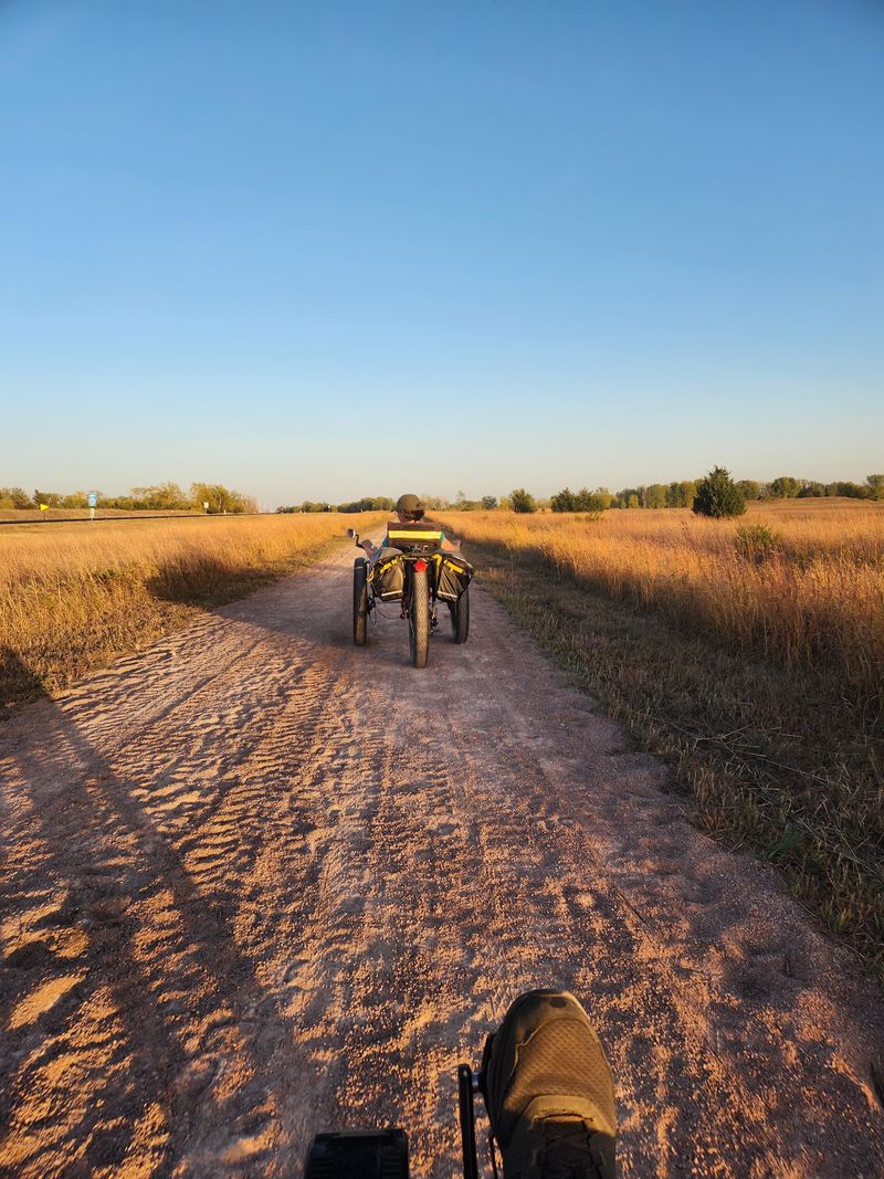
Sandburs are the trail’s sneaky little troublemakers. Also called puncturevine or goat’s head, those sharp seeds can flatten a bike tire fast.
Carry spare tubes and a patch kit. That one habit can save a long walk back to town.
The eastern trailhead sits in Ta-Ha-Zouka Park in Norfolk. A 2.2-mile connector trail was built to make reaching the park easy.
Out west, Valentine access points sit at N Thornton Street and near City Park on Main Street. They’re a few blocks north of where Highway 83 meets Highway 20.
The trail itself has no single street address, since it crosses northern Nebraska. Use those trailheads or any town along the route as your starting line.
Water deserves planning too. Some stretches between services feel longer than others, so fill up whenever you pass a park.
Nebraska Game and Parks provides official maps and trail condition updates. Checking them before you leave helps you pick the right section for your legs and your bike.
Still Growing Toward Chadron And A Coast-To-Coast Dream
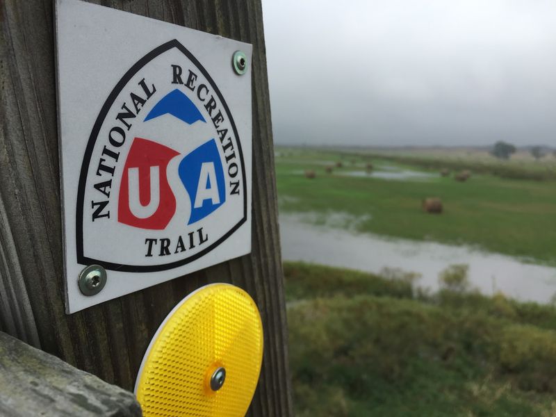
Believe it or not, 195 miles isn’t the finish line. A separate segment of about 17 miles already runs between Gordon and Rushville in western Nebraska.
That piece was completed in 2019. It gives Panhandle-area visitors their own slice of the trail without driving all the way to Valentine.
Plans call for extending the route to Chadron someday. The finished trail would stretch past 300 miles and rank among the longest rail-trail conversions in the country.
The Cowboy Trail also belongs to the Great American Rail-Trail. That project aims to link a continuous path across the entire United States.
So the walk you take near Norfolk or Neligh connects to something much bigger. Pretty cool for a corridor once written off as abandoned track.
My verdict is simple. Pick a town, grab some water and walk a few miles of Nebraska history.
Whether it’s one afternoon or a week, the trail rewards curiosity. Those old trains left behind a path anyone can still follow today.