Halfway Across This Nebraska Footbridge Over The Missouri River, You Stand In Two States At Once
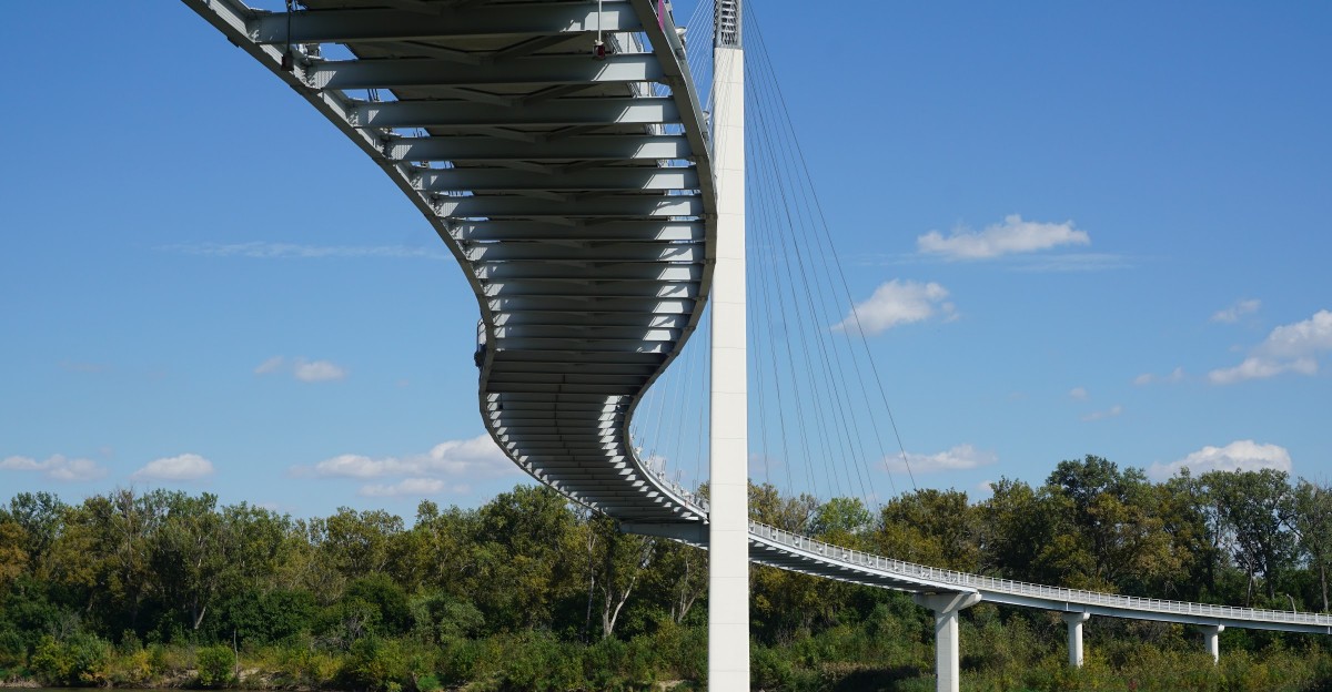
The plan was nothing bigger than stretching my legs after a long drive across Nebraska. A paved path, a wide brown river, and a bridge that seemed to bend in a lazy S across the water did not look like much at first.
Then, halfway over, a painted line under my shoes announced that one foot was in Nebraska and the other was in Iowa. That quick walk turned into the part of the trip I still tell people about.
A Footbridge Linking Omaha to Iowa
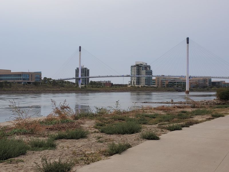
Picture a wide, paved path leading away from downtown Omaha, where traffic noise thins out and the Missouri River opens up ahead. At the end of that path stands the Bob Kerrey Pedestrian Bridge, a cable-stayed footbridge that carries walkers and cyclists from Nebraska straight into Iowa.
The Omaha end sits at 705 Riverfront Drive, a short hop from the rest of the riverfront.
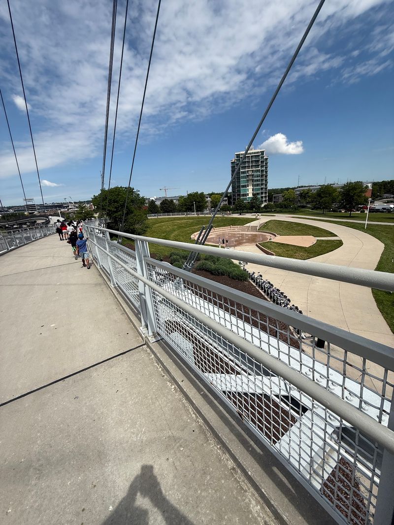
Roughly 3,000 feet long, the span stretches slightly over half a mile and counts as one of the longest pedestrian bridges connecting two states. Its deck is 15 feet wide, leaving plenty of elbow room for strollers, runners, and bikes sharing the same lane.
That width matters on busy weekends, and the far end lands in Council Bluffs, where a broad park waits.
How long does the crossing take? About fifteen minutes on foot, which makes it easy to fit into a lunch break, a layover, or a lazy weekend morning.
Cars never enter the picture, so the whole trip is paced by footsteps and bike wheels instead of engines. Around Omaha, the bridge goes by a single, friendly nickname: Bob.
Straight Lines That Pretend to Curve
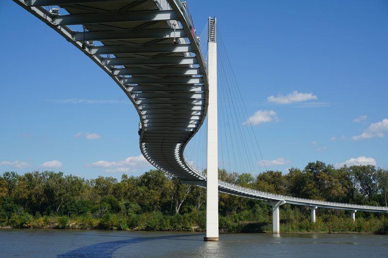
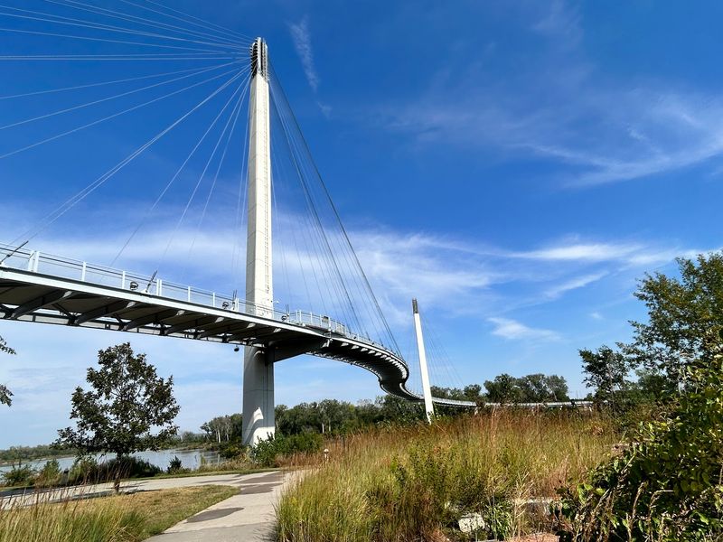
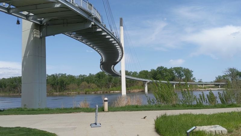
From the riverbank, the bridge looks like it bends in a soft S across the water, yet not a single piece of it is curved. The effect is an optical illusion built from straight segments set at slight angles to one another.
Stand at either ramp and the trick holds up surprisingly well.
The bridge opened in September 2008, giving walkers and cyclists a dedicated route between Omaha and Council Bluffs. Its deck rides about sixty feet above the water, high enough to turn an ordinary stroll into a view from above.
Tall pylons and fanned cables hold the whole thing up, which is what makes it a cable-stayed design rather than a true suspension bridge.
Up top, the wind is noticeably stronger than on shore, and the temperature can shift as you move out over the channel. Looking down, the brown current slides past in long ripples, carrying bits of driftwood south.
Cables fan out in neat rows overhead, catching the sun on clear afternoons, and a few minutes at the railing shows how much the height and open sightlines add to the walk.
Where Nebraska Ends and Iowa Begins
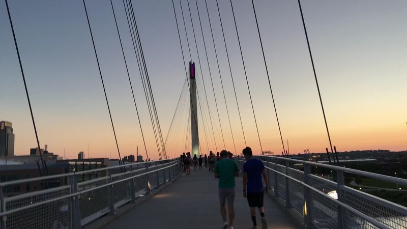
How many places let you stand in two states without taking a single step? At the midpoint of the bridge, a clearly marked line splits the deck between Nebraska and Iowa, with signage spelling out which state is which.
One foot goes on either side, and suddenly you are officially in both at once.
Striking that pose has its own name: bobbing. It borrows from the bridge’s nickname, and it has become the classic photo here, whether it is a solo snapshot, a family lineup, or a couple straddling the border hand in hand.
Strangers passing by often offer to take the picture, which keeps the midpoint cheerful and a little social.
Chalk is often on hand near the line, too. Kids and grown-ups leave names, hearts, and dates in pastel scribbles that fade with the next rain, so the painted signage stays clean.
Right foot in Nebraska, left foot in Iowa, or the other way around, there is no wrong way to do it, and it is a playful way to mark the moment without leaving anything permanent behind.
After Dark on the Missouri
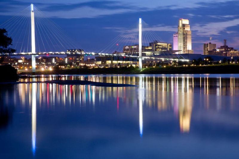
Evening settles over the river, and the bridge begins to glow. Colored lights run along the structure, shifting the mood from daytime exercise route to something closer to a slow, easy promenade.
Around the Omaha end, the city hum fades beneath the sound of moving water, and photos taken after sunset look like postcards.
Sunset is the prime window for a crossing. Facing west from the deck, the Omaha skyline turns into a silhouette while the sky behind it cycles through orange and pink, and the water below picks up every shade.
Arriving a little early helps claim a good spot along the railing, and a light jacket helps too, since the breeze off the river strengthens once the sun drops.
Why go later still? After dark, the crowds thin out and the bridge turns calm and open, with soft lights reflecting on the water.
It becomes a place for a quiet walk, a bit of thinking, or simply slowing down after a long day. The bridge stays open around the clock, so a late stroll is always on the table.
Splash Pads, Play Gardens, and a Troll Named OMAR
Shrieks of laughter and the hiss of water jets greet anyone arriving at the Omaha Plaza on a warm day. The plaza’s interactive fountain works as a splash pad, and kids race through the spray long before they ever set foot on the bridge.
Splash first, walk second is a solid plan, even if it ends with damp sneakers.
Across the river, Tom Hanafan River’s Edge Park spreads out in wide green lawns. It holds an amphitheater, the Belles’ Play Garden, benches, extra walking paths, and a handful of public art pieces, including a striking sculpture that practically begs to be photographed.
Those benches face straight back at the Omaha skyline.
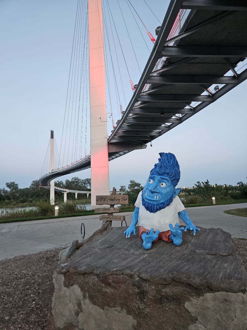
Then there is OMAR. A troll sculpture lives under the bridge, and finding him turns into a small scavenger hunt for younger explorers.
Between the fountain, the play garden, and the troll, an eleven-year-old can stay busy for an entire morning, while grandparents and parents get plenty of spots to sit as the kids burn through their energy. Back on the Nebraska side, a National Park Service visitors center adds a place to cool off and learn something.
History Signs, Trail Links, and a Postage Stamp
Who knew a walk could double as a history class? Interpretive signs along the route explain the Missouri River and its past, including the Native tribes who lived along these banks long before any bridge existed.
Reading them takes only a few minutes, and the trail also ties into the National Park Service visitors center for the Lewis and Clark National Historic Trail.
In 2023, the bridge earned a spot on a United States Postal Service postage stamp, a rare bit of national attention for a Nebraska landmark. That tiny image of the span traveled on envelopes across the country.
It confirmed what anyone who has crossed already suspects: the design stands out, and not bad for a footbridge.
Cyclists get their own reward. The bridge acts as a gateway to more than 150 miles of connected biking and nature trails around the metro, so a single crossing can stretch into a full day on two wheels.
Bicycle rentals are available nearby for anyone who shows up without a bike, and walkers, runners, and riders all share the deck, which gets lively on pleasant weekends.
Parking, Ramps, and Timing Your Crossing
Nine o’clock on a Saturday morning is a sweet spot here. Parking is easy to find, the temperatures are still mild, and the crowds have not yet arrived.
Later in the day, heat and foot traffic tend to build together.
Two ramp entrances lead up to the deck, and the gradual incline makes the climb easy for walkers, bikers, and wheelchairs alike. The bridge is accessible year-round, and no gate closes at night.
A small all-abilities lot near the accessible ramp fits about eight vehicles and has portable restrooms, while the National Park Service lot offers more spaces.
Not everything is built in, though. Drinking fountains are missing from the bridge, so bring water, and keep to one side since scooters sometimes zip through faster than they should.
A newer extension nicknamed Baby Bob, completed in March 2025, now links the bridge more smoothly with downtown Omaha.
Short on time? The location sits close to the airport, so a spare fifteen minutes before a flight is enough for a quick walk out to the state line and back.
An Easy Half Mile With a Big Story
Wind in your hair, river below, a painted line under your shoes: few short walks pack in this much. The Bob Kerrey Pedestrian Bridge turns a simple outing into a small adventure, and it does it without a complicated plan for anyone in eastern Nebraska.
Families get a splash pad and a troll hunt. Cyclists get a launch point for miles of trail, and couples get sunset colors and glowing lights.
History fans get signs about the river, the tribes, and the Lewis and Clark route, while walkers simply get a calm half mile with open sky on every side.
What sticks longest? The moment at the midpoint.
Standing with one foot in Nebraska and the other in Iowa may seem silly on paper, yet it brings out a grin nearly every time. For an afternoon close to home or a spare hour between flights, it earns a spot near the top of the list.
Go once in daylight and again after dark. The bridge feels like two different places, which seems fitting for a spot that sits in two states.