8 Historic Ruins in Idaho That Deserve A Spot On Your Bucket List
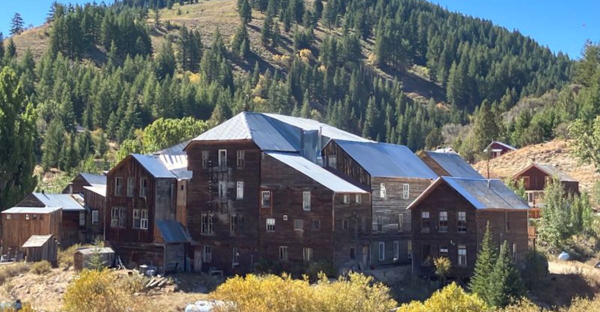
Long before GPS and roadside billboards, entire communities rose and vanished across the American West.
Idaho still holds the remains of places that once felt busy, ambitious, and full of promise. Empty foundations now sit where homes and businesses once stood.
Weathered structures hint at lives shaped by hard work and sudden change.
Walking through these sites can feel strangely personal. The silence makes every doorway, broken wall, and abandoned street seem more vivid.
Nothing here needs dramatic storytelling. Time has already done enough.
These eight historic places offer a closer look at the boom-and-bust years that shaped the state. Some are easy to reach.
Others demand patience and careful planning.
Either way, the reward is the same. You get to stand where entire towns once believed their future had arrived.
1. Bayhorse Ghost Town
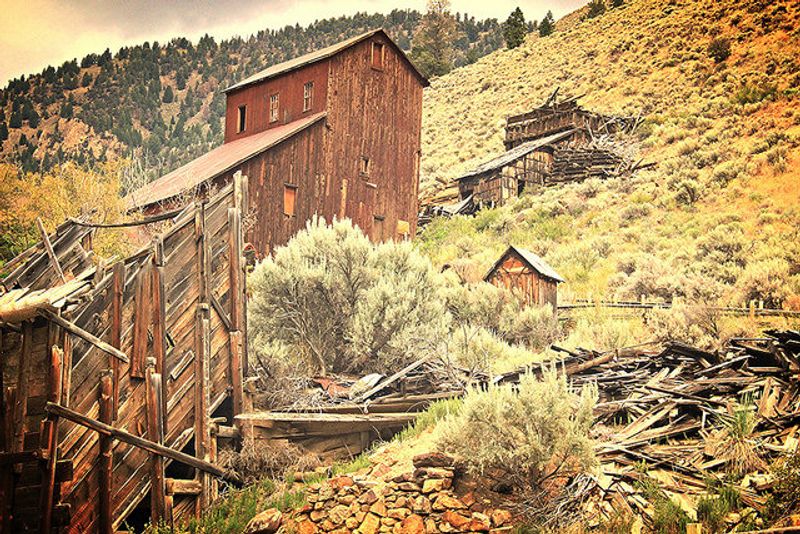
Weathered buildings, charcoal kilns, stone foundations, and industrial remains help visitors understand the scale of the community that once occupied Bayhorse Canyon.
Prospectors began developing mineral claims in the area during the 1870s, when silver, lead, and copper drew workers into this narrow section of central Idaho.
Cabins, businesses, mills, and processing facilities appeared as mining activity increased along Bayhorse Creek. Several important structures have since been stabilized, allowing guests to study the townsite without making it appear newly reconstructed.
Marked routes pass log buildings, stonework, kilns, and remains associated with moving and processing material from nearby mines. Interpretive information explains how mining shaped both the settlement and the surrounding landscape.
Bayhorse belongs to Land of the Yankee Fork State Park and is reached by Bayhorse Creek Road southwest of Challis. Access is generally seasonal because snow, mud, and changing mountain conditions can affect the approach.
Current opening dates and road guidance should be confirmed before traveling, especially during spring or fall. Barriers around fragile features must be respected, and visitors should remain on designated routes rather than entering unstable structures.
Rocks, tools, wood, and other historic materials must stay where they are. A stop at the park’s interpretive center near Challis can provide helpful context and updated information before the drive into Bayhorse Canyon.
2. Custer Historic Mining Town
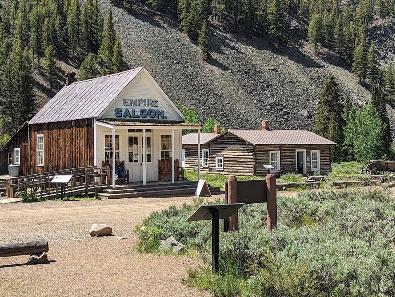
Furnished buildings and preserved community spaces make Custer one of Idaho’s most complete interpreted mining townsites rather than a simple collection of ruins.
Development accelerated in the late 1870s as prospectors and investors moved into the Yankee Fork district, followed by homes, stores, workshops, and public buildings that supported both mine workers and their families.
Household objects, school displays, tools, and other exhibits help explain cooking, education, business, and daily routines in an isolated mountain setting.
That level of interpretation makes the site easier to understand than a landscape made up only of foundations and machinery.
Custer is part of Land of the Yankee Fork State Park and lies along the Yankee Fork road system northwest of Stanley. Nearby Bonanza and the Yankee Fork Gold Dredge can be included in the same trip for a broader look at mining activity across the district.
Snow, weather, and seasonal maintenance can affect access, so travelers should check current road information before leaving and carry water, food, and an offline map. Preserved interiors should be entered only where public access is clearly allowed.
3. Bonanza Ghost Town
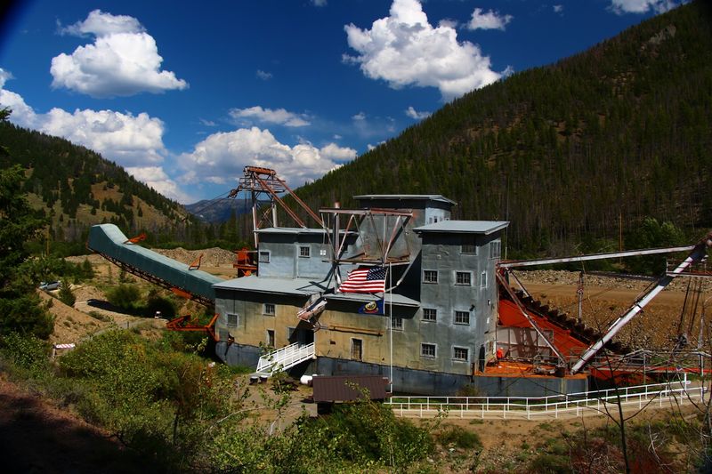
Open lots, scattered structures, foundations, and a historic cemetery mark the former mining community of Bonanza beside the Yankee Fork.
Gold discoveries encouraged settlement during the 1870s, bringing workers, merchants, tradespeople, lodging operators, and families into the district.
Shops and other services developed as Bonanza became an early commercial center for nearby mining activity. Fires damaged important parts of the town during its active years, while changing business patterns and the growth of neighboring Custer gradually reduced its influence.
Mining continued elsewhere in the region, but Bonanza never returned to its earlier size. Remaining buildings, cemetery grounds, foundations, and the open arrangement of the townsite now provide evidence of the community that once stood there.
Bonanza lies only a short distance from Custer, making the two historic sites practical to combine during one carefully planned visit. The Yankee Fork Gold Dredge can also add useful industrial context to the trip.
Private holdings remain within and around the area, so visitors must follow signs and stay on established public routes. Old porches, walls, roofs, and doorways may be unstable even when they appear accessible.
Cemetery markers deserve respectful treatment, and no object should be moved, removed, or damaged.
Water, basic supplies, and current road information are important because services remain limited throughout this remote section of central Idaho.
4. Silver City Historic District
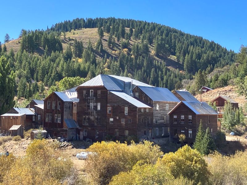
Rows of nineteenth-century buildings give Silver City a more complete townscape than many former mining settlements in Idaho.
Gold and silver activity encouraged rapid growth in the Owyhee Mountains during the 1860s, leading to homes, shops, government offices, newspapers, and service businesses.
Silver City also served as the Owyhee County seat before administrative operations eventually moved to Murphy. Population declined gradually, which allowed many buildings to remain standing rather than disappearing during one brief period of abandonment.
That survival gives the district unusual architectural depth, but it also means Silver City should not be described as an empty public ruin.
Numerous properties remain privately owned, and some buildings continue to receive seasonal use.
Visitors must remain on public roads and enter structures only when permission is clearly provided. The town sits at the end of a remote mountain route southwest of Murphy, where unpaved stretches can become rough, muddy, deeply rutted, or blocked by snow.
Fuel, food, drinking water, and other basic supplies should be secured before leaving the highway because services are extremely limited. Current road conditions should be checked locally, particularly outside the main warm-weather travel period.
Careful sightseeing can reveal historic streets, homes, commercial buildings, and industrial traces without intruding on private property or treating the community as an unrestricted attraction.
5. Burke Ghost Town
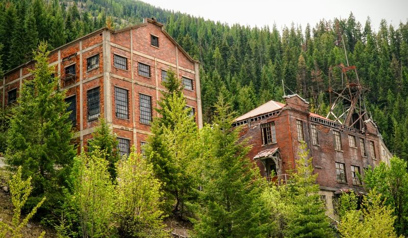
Steep canyon walls forced Burke’s residents to fit homes, businesses, rail lines, roads, and mining facilities into an unusually narrow section of northern Idaho.
Lead and silver activity expanded during the late nineteenth century, drawing workers into the Silver Valley and leaving very little level ground for conventional construction.
Buildings climbed the surrounding slopes, transportation routes crowded beside Canyon Creek, and one hotel famously extended across both the creek and the railroad because space was so limited.
Mining lasted much longer here than in many nineteenth-century communities, leaving concrete industrial structures, foundations, altered hillsides, and scattered buildings visible along the canyon road.
Burke lies northeast of Wallace and is best approached as a slow roadside history drive rather than an unrestricted walking destination. Private property boundaries must be respected, and abandoned buildings should never be entered.
Historic mining also left widespread metals contamination across parts of the Coeur d’Alene Basin. Visitors should follow posted environmental guidance, avoid disturbing soil or dust, and wash hands before eating after spending time in affected areas.
Children and pets should be supervised carefully around bare ground and abandoned industrial sites.
The town’s compressed arrangement still offers a clear look at how residents adapted housing, transportation, business, and daily routines to a canyon that supported mining activity but provided very little room for a typical street grid.
6. Gilmore Ghost Town
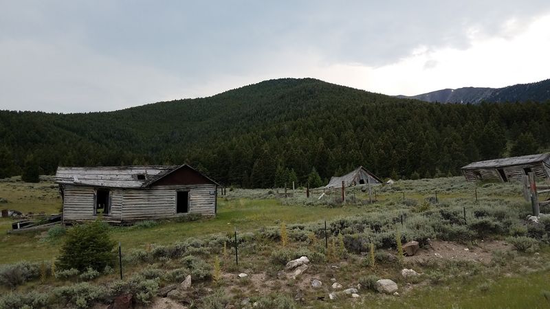
Health guidance must come before sightseeing at Gilmore because Idaho environmental officials have confirmed high concentrations of lead and arsenic in soil and dust at and near the townsite.
Lead and silver mining supported the community during the early twentieth century, while the arrival of the Gilmore and Pittsburgh Railroad improved transportation for ore, equipment, supplies, and passengers.
Homes and businesses expanded around the mining operations until declining production weakened the local economy and rail service eventually ended. Several weathered buildings still stand, but age, exposure, and structural deterioration make entry unsafe.
Anyone considering travel through the area should review current Idaho Department of Environmental Quality information before arriving.
Visitors should remain on established roads or other recommended surfaces, avoid disturbing soil, and never collect rocks, wood, metal, glass, or other materials from the site.
Children and pets should not play on the ground because contaminated dust can create serious health risks. Food should not be handled until hands have been cleaned thoroughly.
Gilmore lies in a remote section of Lemhi County west of Idaho Highway 28, where services, phone coverage, and immediate assistance may be limited.
The townsite remains historically significant because of its connection to mining and railroad development, but it should not be approached as a casual recreational stop.
Responsible viewing depends on following official precautions and limiting contact with contaminated areas.
7. De Lamar Ghost Town
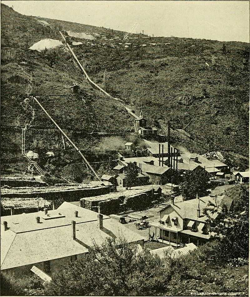
Scattered stonework and limited structural remains record the former mining community of De Lamar in the Owyhee Mountains, but current access should never be assumed.
Joseph DeLamar invested in mineral claims during the late 1880s and helped develop a settlement that included homes, stores, a school, boarding facilities, and ore-processing buildings.
Mining supported local business and employment for years, although occupational health risks were also part of the community’s history. Dry drilling exposed workers to silica dust, contributing to serious lung disease among miners.
Much of the original townsite has changed through weathering, structural loss, and later industrial activity. Modern mining interests in the wider DeLamar area may also affect roads, land use, and public access.
Anyone considering a trip should confirm current conditions with the Bureau of Land Management, county officials, or the relevant property manager before leaving home.
Roads shown on older maps may cross private holdings, claimed land, restricted property, or active operations.
Gates, closures, and warning signs must always be followed, even when a route appears passable. De Lamar belongs in an article about Idaho’s mining history, but it should not be presented as a guaranteed public attraction.
Lawful access, current land status, road conditions, and safety information must all be verified before attempting to approach the surviving remains.
8. Florence Ghost Town
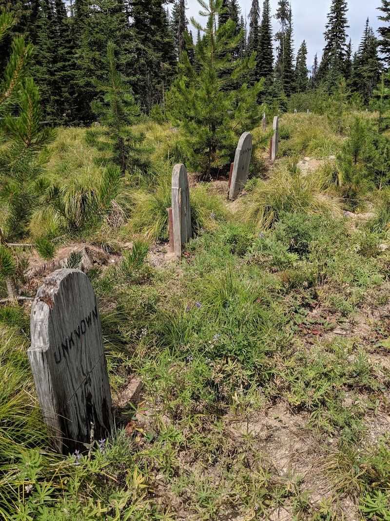
Forest growth has reclaimed much of Florence, leaving cabins, foundations, cemetery markers, and scattered structural remains among trees and open clearings.
Gold discoveries in 1861 triggered rapid growth, bringing miners, merchants, and supporting businesses into the area during the settlement’s earliest period.
Difficult winter weather, limited supplies, isolation, and changing mining prospects challenged the community from the beginning. Florence briefly served as the Idaho County seat before declining production shifted population and government activity elsewhere.
Later mining revivals brought renewed interest, but none restored the settlement to its original scale. Reaching Florence requires a lengthy drive over steep, narrow, and sometimes rough forest roads rather than a quick detour from U.S.
Highway 95. Weather, fallen trees, road maintenance, washouts, wildfire restrictions, and seasonal closures can all change the route.
Travelers should follow current Forest Service directions, download maps before leaving, carry extra water and food, and expect limited or unavailable phone coverage.
A high-clearance vehicle may be useful depending on current road conditions, though official local guidance should determine whether travel is advisable.
Remaining buildings must be viewed cautiously because moisture, age, snow loads, and decay have weakened many materials.
Cemetery grounds and historic features deserve respectful treatment, while cabins, foundations, and artifacts should remain undisturbed.
Careful preparation makes it possible to study Florence’s history without understating the remoteness of the journey.
Disclaimer: The information in this article is provided for general informational and travel inspiration purposes only.
Historic mining sites, ghost towns, and abandoned communities are dynamic places where road conditions, public access, ownership, preservation efforts, environmental hazards, and safety conditions can change without notice.
Readers should always verify the latest information with the appropriate managing agency before planning a visit.
Many of the locations featured here are managed by organizations such as Idaho State Parks, the U.S. Forest Service, the Bureau of Land Management, local counties, or other public agencies.
Others include privately owned land, active mining claims, seasonal residences, or restricted property. Inclusion in this article does not mean every structure, road, trail, or surrounding area is open to the public.
Always obey posted signs, gates, closures, and property boundaries, and never enter private property or restricted areas without permission.