10 Massachusetts State Parks That Feel Like National Parks Without The Crowds
Mountains this weekend or an island adventure? How about a waterfall instead?
Massachusetts squeezes an impressive variety of outdoor escapes into one state, making that decision wonderfully difficult.
Summit hikes bring sweeping views, forest trails lead toward cascades, and ponds invite swimming or paddling when temperatures climb.
Elsewhere, coastal landscapes and historic sites create completely different outings. You could choose a new setting every weekend and keep the hiking shoes busy.
Camping stretches some visits even further. Check current conditions, match the trail to your plans, and go.
Big outdoor days do not always need elaborate travel arrangements, especially when this many landscapes are waiting within driving distance.
1. Mount Greylock State Reservation, Lanesborough
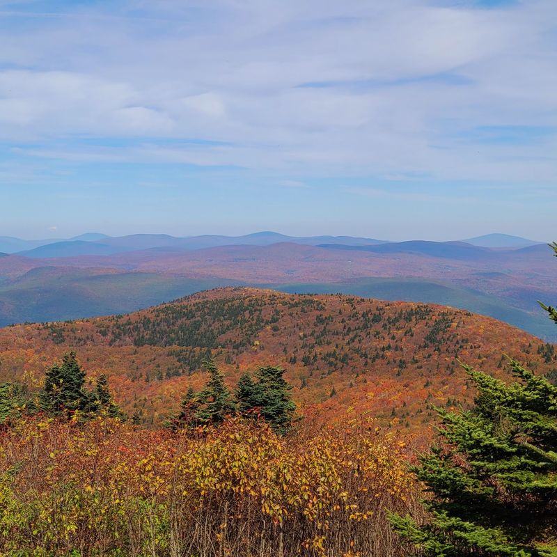
My jaw dropped the first time those layered ridges rolled out in every direction. At 3,491 feet, this is the rooftop of the whole state.
Mount Greylock State Reservation in Lanesborough serves up views across five states on clear days. Massachusetts, Vermont, New York, Connecticut, and New Hampshire all appear at once.
Named the state’s first wilderness park in 1898, it protects a rare boreal forest. Red spruce and balsam fir grow here like they do far north in Canada.
Hikers get more than 68 miles of trails, easy strolls to lung-burning climbs. Roughly 11.5 to 13 miles of the Appalachian Trail follow the ridgeline.
Prefer wheels? Rockwell Road, a 16-mile Scenic Byway, climbs to the summit from mid-May through early November.
The 93-foot Veterans War Memorial Tower crowns the top with an even wider outlook. Bascom Lodge nearby serves meals and rooms during the warmer season.
On the western flank, a huge glacial cirque called The Hopper shelters old-growth hemlock and 200-year-old red spruce. Wildlife watchers should bring binoculars for warblers and hawks.
Sperry Road Campground handles primitive hike-in camping, while winter brings cross-country skiing and snowmobiling. Mountain bikers find plenty of gravel and singletrack too.
Start at the visitor center, 30 Rockwell Road, Lanesborough, for maps and exhibits. Sunrise here beats any alarm clock in New England.
2. Savoy Mountain State Forest, Florida and Savoy
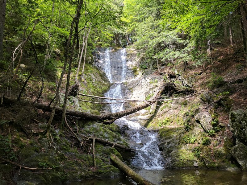
Western Massachusetts hides scenery that looks borrowed from Oregon. Ferns, moss, and dark wet rock set the mood immediately.
Savoy Mountain State Forest, spread across Florida and Savoy, covers more than 10,000 rugged acres. It sits high in the Hoosac Mountain Range.
Tannery Falls steals the show, tumbling 75 to 100 feet in stacked tiers. The mossy gorge around Ross Brook keeps the air cool even in August.
Parker Brook Falls adds another 40 to 60 feet of cascades just steps away. Two waterfalls, one short walk, zero shuttle buses.
Four ponds dot the forest: North, South, Bog, and Burnett. North and South have swimming beaches plus picnic tables in the shade.
Bog Pond is the oddball favorite, with floating bog islands and a dedicated canoe launch. Paddling past those drifting mats is strangely peaceful.
More than 50 miles of wooded trails invite hiking, mountain biking, and winter cross-country skiing. About 120 acres of old-growth trees, some 150 to 400 years old, grow near the Cold River and the falls.
Overnight guests choose from 45 roomy campsites or four log cabins overlooking South Pond. The Civilian Conservation Corps built those cabins back in the 1930s.
The Tannery Falls Trail runs a moderate 0.6 miles round trip, though vehicle access to that lot usually opens June 1 through December 31. Pack a towel and go chase water.
3. Mohawk Trail State Forest, Charlemont
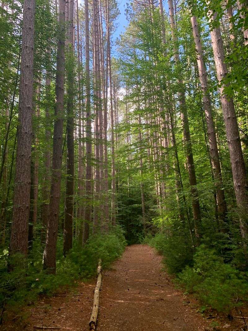
You took the words right out of my mouth about trees that dwarf everything around them. Some were already standing before the United States existed.
Mohawk Trail State Forest in Charlemont spreads over 6,000 acres of ridges and deep gorges in the northern Berkshires. Old-growth areas span roughly 400 to 700 acres.
Eastern hemlocks here have been dated to 500 years, with red spruce reaching 400. Standing beneath them, conversations tend to drop to a whisper.
The Cold River slices dramatic gorges straight through bedrock. Trout anglers work more than 18 miles of rivers and streams inside the forest.
Its name honors the historic Mohawk Trail, an ancient Native American footpath. That route linked the Hudson and Connecticut River valleys for thousands of years.
Over 50 miles of trails wind through the hills, including stretches of the Mahican-Mohawk Trail. Hiking, mountain biking, and snowshoeing all work beautifully here.
A designated swimming area cools things down on humid summer afternoons. Shade is never far away in these woods.
Camping means 53 wooded sites or six rustic log cabins. Cabins stay open year-round while campsites run mid-May through mid-October, and reservations are required.
Flush toilets and showers exist, though some cabins rely on wood stoves without running water. The CCC built much of this in the 1930s.
Find the entrance on Cold River Road, Charlemont. Bring a wide-angle lens for those giants.
4. Myles Standish State Forest, Carver And Plymouth
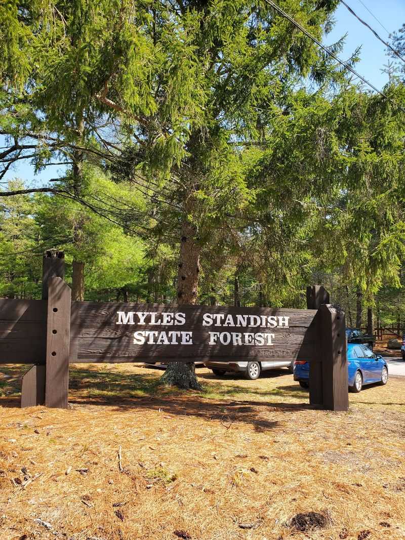
Are you seeing what I am seeing? Southeastern Massachusetts looks nothing like postcard New England out here.
Myles Standish State Forest, stretching across Carver and Plymouth, tops 12,000 acres. It is the largest public recreation area in the region.
Nearly five dozen coastal plain kettle ponds sit scattered through the woods. Glaciers dug them, and groundwater fills them.
The landscape belongs to the Atlantic coastal pine barrens, all pitch pine and scrub oak. This fire-adapted habitat shelters over 50 rare and endangered plants and animals.
Trail options run deep: 13 miles for hikers, 15 miles of paved bike paths, and 35 miles of equestrian routes. Sandy soil keeps the paths drying fast after rain.
Five camping areas hold close to 400 sites for tents, RVs, and horse trailers. Yurts suit anyone who wants walls without hauling gear.
Many sites sit near Barrett, Charge, and Fearing Ponds, so swimming is minutes from your tent. Charge Pond pairs clear water with sandy beaches and equestrian camping nearby.
Ponds stocked with bass, perch, pickerel, and trout keep anglers busy. Canoes and kayaks glide easily on the calm surfaces.
Sunrise here brings whip-poor-will calls and a pine scent that sticks with you. Headquarters sits at 194 Cranberry Road, Carver. Come midweek and you may hear nothing but wind through needles.
5. Boston Harbor Islands National And State Park
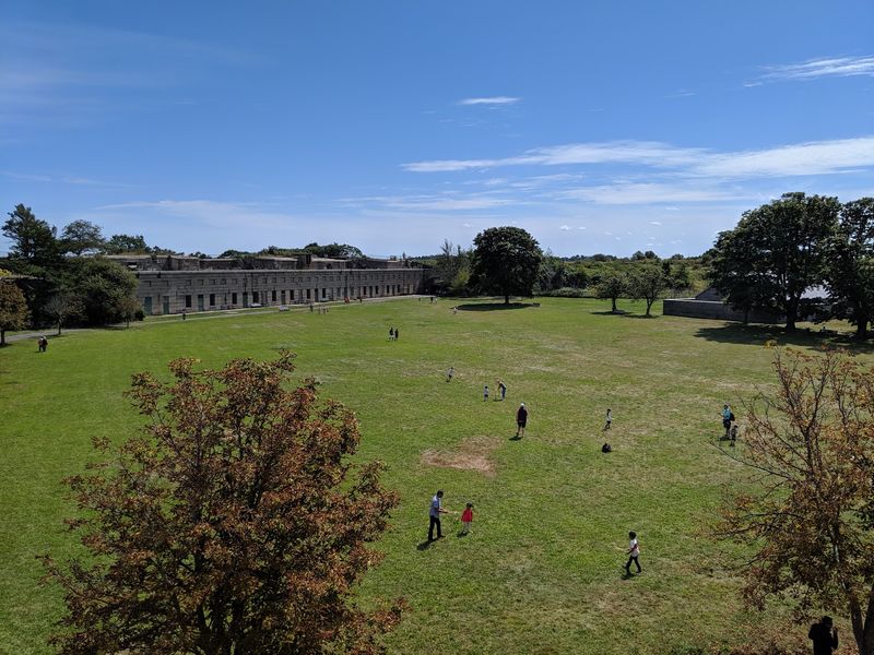
A wild escape twenty minutes from a major skyline sounds unlikely. Then the ferry pulls away and the noise disappears.
Boston Harbor Islands National and State Park gathers 34 islands and peninsulas across the harbor. Access comes by seasonal public ferry from Long Wharf or Hingham, or by private boat.
Georges Island holds Fort Warren, a Civil War-era fortress and National Historic Landmark. Its granite walls and shadowy tunnels reward a flashlight.
Spectacle Island counters with five miles of walking trails, including an accessible perimeter loop. North Drumlin, the harbor’s highest point, delivers 360-degree city views.
A lifeguarded beach there makes swimming easy on hot afternoons. Ice cream and shade are both within reach.
Peddocks Island, one of the largest and most varied, has wooded tent sites and yurts. Historic Fort Andrews and a World War II-era chapel share the same shoreline.
Bumpkin, Grape, and Lovells add quieter trails and stone ruins to explore. Each island has its own personality.
Boston Light on Little Brewster Island, America’s oldest continually used lighthouse, appears on narrated cruises. Photographers love that white tower against open water.
Rocky shores, salt marshes, and tidal flats make this an Important Bird Area. Bring binoculars for terns and herons.
The Welcome Center stands at 191W Atlantic Ave, Boston. Check the ferry schedule twice, then relax.
6. October Mountain State Forest, Lee And Washington
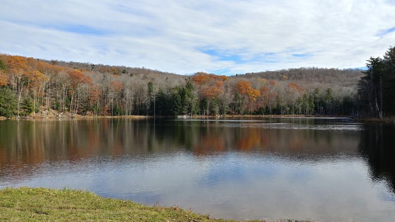
You could have knocked me over with a feather learning how enormous this wilderness really is. Over 16,000 acres, and hardly anyone around.
October Mountain State Forest sits mostly in Washington, reaching into Lee, Lenox, and Becket. It ranks as the largest state forest in Massachusetts. That scale explains the backcountry hush. Weekend crowds simply never materialize here.
Trails suit every fitness level, including a stretch of the Appalachian Trail. One standout route passes through Schermerhorn Gorge, a rocky feature geologists have studied for generations.
October Mountain Reservoir supplies beach areas for swimming, fishing, and non-motorized boating. Largemouth bass keep anglers casting until dusk.
Off-road vehicle trails exist too, though they suit intermediate and expert riders. Winter flips the script with cross-country skiing and snowmobiling.
Hunting and wildlife watching happen across the varied terrain, from wetlands to hardwood slopes. Moose tracks are not unheard of.
Camping runs mid-May through mid-October with 44 to 47 sites plus three yurts. Each site includes a picnic table, fire ring, and food storage locker.
Comfort stations bring hot showers and flush toilets, a welcome luxury after muddy miles. Reserve early for foliage weekends.
Fun bit of trivia: author Herman Melville, whose Pittsfield home overlooked these hills, gets credit for the name. The main camping area is at 256 Woodland Road, Lee.
7. Wells State Park, Sturbridge
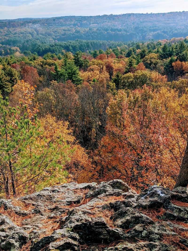
That came completely out of left field, finding deep quiet so near busy roads. Central Massachusetts keeps this one under wraps.
Wells State Park in Sturbridge protects roughly 1,400 to 1,470 acres of calm woodland. Rocky ledges alternate with wetlands throughout.
Oak-hickory and northern hardwood forest dominate, broken by groves of eastern white pine. Established in 1968, the park still reads as untouched.
Carpenter Rocks is the payoff hike, a metamorphic cliff face with sweeping views. You look out over the eastern arm of Walker Pond and the wooded valley beyond.
Walker Pond itself covers 104 serene acres at the park’s heart. Non-motorized boating and fishing rule the water.
The swimming beach is reserved for registered campers, which keeps things mellow. Largemouth bass, chain pickerel, and several perch species live below the surface.
Between 10 and 12 miles of trails welcome hikers, mountain bikers, horseback riders, and winter skiers. Trail junctions are well marked for first timers.
Summer brings interpretive programs, guided walks, and evening campfire talks. Kids usually end up with sticky marshmallow fingers.
Overnight options include 60 campsites, one group site, and four yurts near the pond. Every site has a picnic table, pedestal grill, and fire ring.
Accessible comfort stations supply hot showers and flush toilets. The address is 159 Walker Mountain Road, Sturbridge, and canoe season starts early.
8. Mount Holyoke Range State Park, Hadley And Amherst
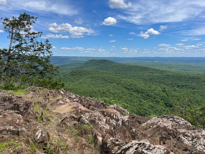
I had to do a double-take hearing you can traverse a whole mountain range in an afternoon. No ropes, no technical moves, just boots.
Mount Holyoke Range State Park covers more than 3,000 acres in the Pioneer Valley. It holds the eastern half of a distinctive 7-mile traprock ridge running through Hadley, Amherst, and neighboring towns.
The Metacomet-Monadnock Trail follows the ridge crest, and the vistas are the reason people come. Views of the Connecticut River Valley stretch for miles.
Ancient volcanic lava flows built these basaltic cliffs and talus slopes. Geology fans get a free outdoor lesson.
Over 30 miles of trails range from short loops to steady climbs. The 8-mile Seven Sisters route rolls over summit after summit toward the Holyoke Summit House.
For something shorter, the 3.4-mile Horse Caves Loop explores shadowy ledges and rock alcoves. Bring a headlamp for the darker nooks.
Mountain bikers favor the Serpentine and Roller Coaster trails. Horseback riders, runners, snowmobilers, and skiers all get their seasons here.
Foliage typically peaks around mid-October, and the color from the ridge is hard to beat. Weekday mornings mean parking spaces and quiet overlooks.
No campsites exist inside the park, so plan a day trip. Begin at the Notch Visitor Center, 1500 West Street, Amherst, where restrooms and picnic areas wait.
9. Nickerson State Park, Brewster
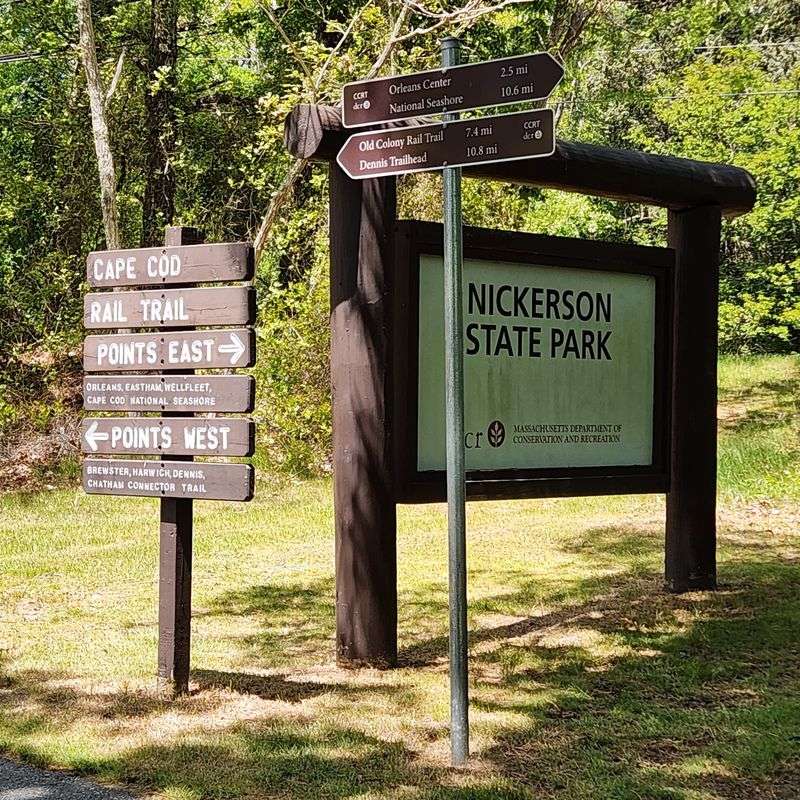
It makes you wonder, doesn’t it, how a slice of Cape Cod can skip the dunes entirely? Dense pines and freshwater run the show here.
Nickerson State Park in Brewster spans about 1,900 acres of restorative calm. Salt marshes and beach traffic feel far away.
Eight crystal-clear kettle ponds anchor the park, carved by glaciers over 10,000 years ago. Cliff Pond is the largest, joined by Flax, Little Cliff, and Higgins.
Groundwater and rainfall alone feed them, so levels shift with the seasons. Swimmers, canoers, and kayakers all rave about the clarity.
An 8-mile paved bike path network threads the woods and links to the 26-mile Cape Cod Rail Trail. Riding under pitch pine, scrub oak, spruce, and white cedar is pure vacation.
Camping goes big with more than 400 sites, including tent, RV, and yurt choices. Most tuck into pine and oak shade.
Four ponds get stocked with trout year-round, so pack a rod. Early morning casts often come with loon calls.
Family-friendly hiking trails, horseback riding, picnicking, and bird watching round out the day. Ranger programs keep young explorers busy.
History note: this became the Commonwealth’s first state park in 1934, donated by Roland C. Nickerson’s widow. Find it at 3488 Main Street, Brewster, and book camping months ahead.
10. Bash Bish Falls State Park, Mount Washington
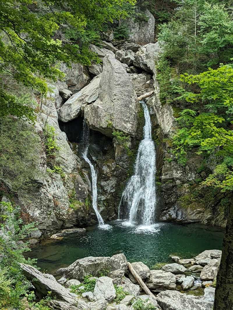
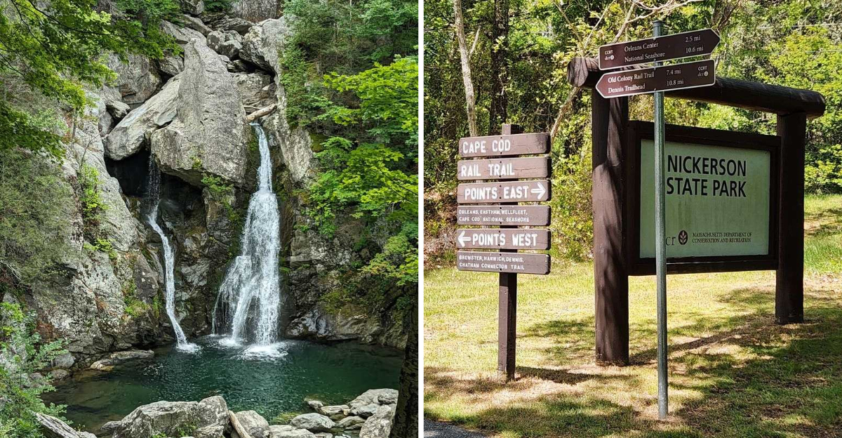
Sounds too good to be true, but the tallest single-drop waterfall in Massachusetts hides in the state’s southwest corner. Very few people are ever standing there with you.
Bash Bish Falls State Park in Mount Washington sits deep in the Taconic Mountains. Storybook is the only word that fits the setting.
The falls plunge somewhere between 59 and 80 feet into an emerald pool. The final cascade splits into twin ribbons around a massive jutting boulder.
Hemlock-hardwood ravine forest surrounds the gorge, with maple, oak, and beech on the slopes. Old-growth pockets add to the biodiversity.
Bash Bish Brook has carved a valley 1,000 feet deep between Bash Bish Mountain and Cedar Mountain. Standing in it feels genuinely wild.
Important safety note: swimming and rock climbing are strictly prohibited due to dangerous currents. Admire that pool with your eyes only.
Two access routes exist. The Massachusetts lot leads to a rugged 0.6-mile round trip, while the New York lot in adjoining Taconic State Park starts a gentler 1.5 to 1.6-mile walk.
Sturdy shoes matter on the steep, rocky sections. Spring runoff makes the water thunder loudest.
Mount Washington State Forest sits next door with wilderness camping and 30 miles of trails, including the South Taconic Trail. The park address is Falls Road, Mount Washington. Go early, stay quiet, and let the roar do the talking.