This 73-Mile Idaho Bike Trail Follows An Old Railroad Through Mountains, Wetlands, And Historic Towns
Seventy-three paved miles can change the way a person thinks about a bike ride.
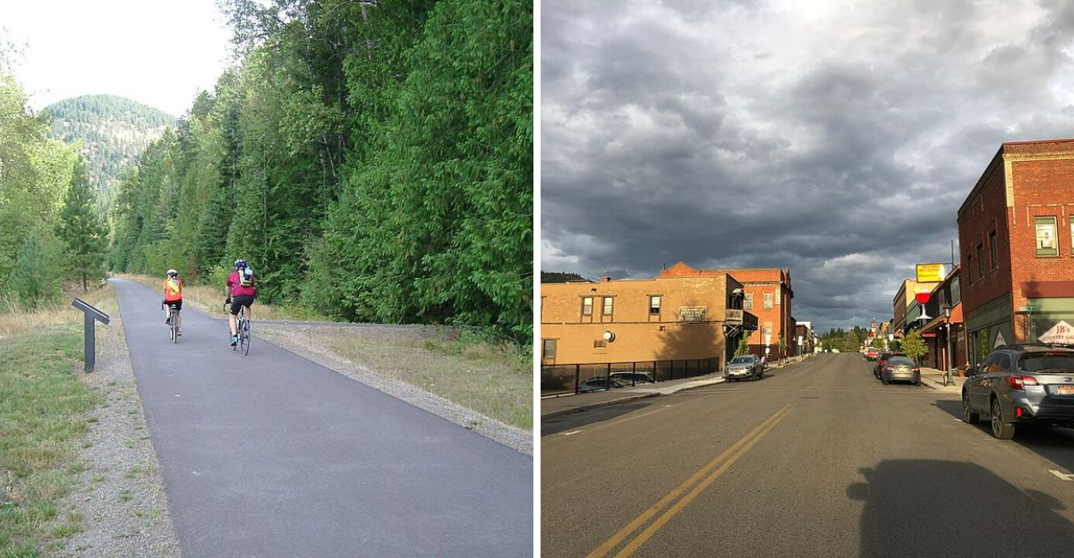
This northern Idaho route follows an old railroad corridor across a landscape that keeps shifting without ever feeling rushed. The pavement stays smooth, the grades remain approachable, and the scenery has plenty of chances to steal attention from the handlebars.
That balance is what makes the trail so memorable.
You do not need to tackle the entire distance to understand its appeal. Even a shorter section can feel like a proper escape, especially when the road disappears behind you and the quiet starts doing most of the work.
The route earned national recognition in 2010, but the praise makes more sense once the first few miles pass beneath the wheels.
Some rides are about speed. This one rewards curiosity.
Take your time, stop when the view demands it, and do not be surprised when the return trip starts sounding like a very good idea before the first one is even over.
Ride A Rail Trail That Keeps Changing Around You
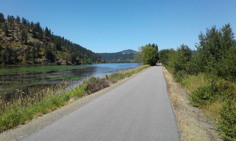
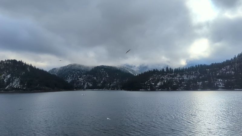
Leave Plummer and the first miles feel open, with farmland spreading beyond the pavement and low hills marking the horizon. The route soon enters the forested Plummer Creek Canyon, reaches Chatcolet Bridge, and begins following the shoreline of Lake Coeur d’Alene.
Farther east, water remains close as the trail moves beside the Coeur d’Alene River, marshes, and the chain-of-lakes region.
Mountain walls gradually tighten around the corridor near the Silver Valley, where historic mining towns replace the open lake and wetland views.
That steady progression gives a long ride natural variety without relying on steep climbs or technical terrain. Much of the route follows the former railroad grade, so the elevation changes are gentler than the surrounding mountains might suggest.
Smooth pavement can make the opening miles feel effortless, but riders still need to respect the return distance. Wind, heat, and fatigue become more noticeable after several hours in the saddle.
A point-to-point plan, commercial shuttle, or carefully chosen turnaround can prevent the final miles from becoming unpleasant. The landscape changes often enough that riders covering one section will see more than a single type of Idaho scenery.
That variety keeps shorter rides rewarding from start to finish overall.
Watch Wetlands And Mountain Views Trade Places All Day
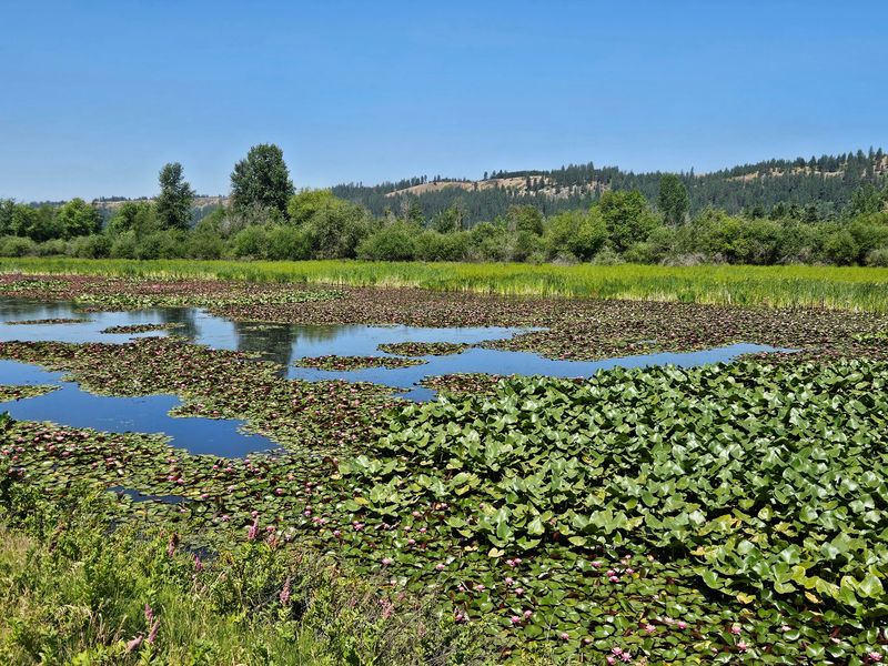
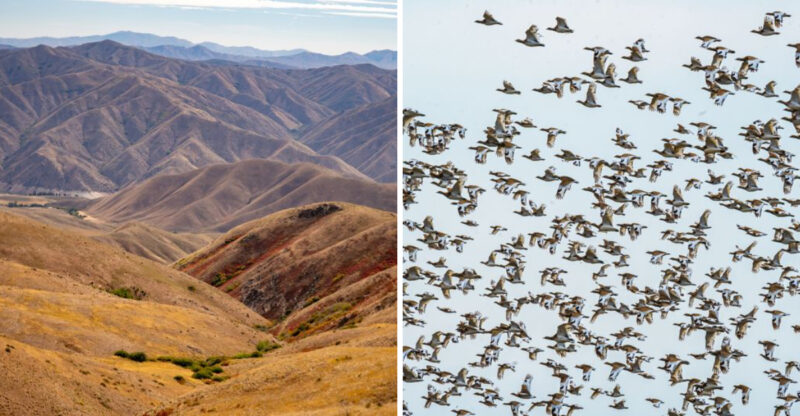
The trail’s middle miles pass through a wetland corridor where open water, reeds, forested hills, and river bends share the same view. Fifteen small lakes and marshes lie near the route, creating habitat for waterfowl, raptors, deer, and moose.
Bald eagles, osprey, herons, and other birds may appear overhead or along the shoreline, though every sighting depends on timing and luck.
Give wildlife plenty of space, especially when larger animals stand close to the pavement or young animals are nearby.
Slowing down protects both the rider and the animal while making the moment easier to appreciate. Morning often brings calmer air and more active birdlife, but changing weather can quickly reshape the experience.
Binoculars are more useful than approaching the water for a closer photograph. The wetlands deserve attention even when no animals appear.
Reflections, layered vegetation, and the gradual return of mountain scenery make this section feel spacious and quiet. The transition toward the eastern valleys happens slowly enough to notice every change.
By the time the route reaches the Silver Valley, the soft wetland landscape has given way to a narrower mountain corridor with an entirely different atmosphere. Few paved routes shift character so completely within one day.
Pass Through Small Towns That Make Great Break Stops
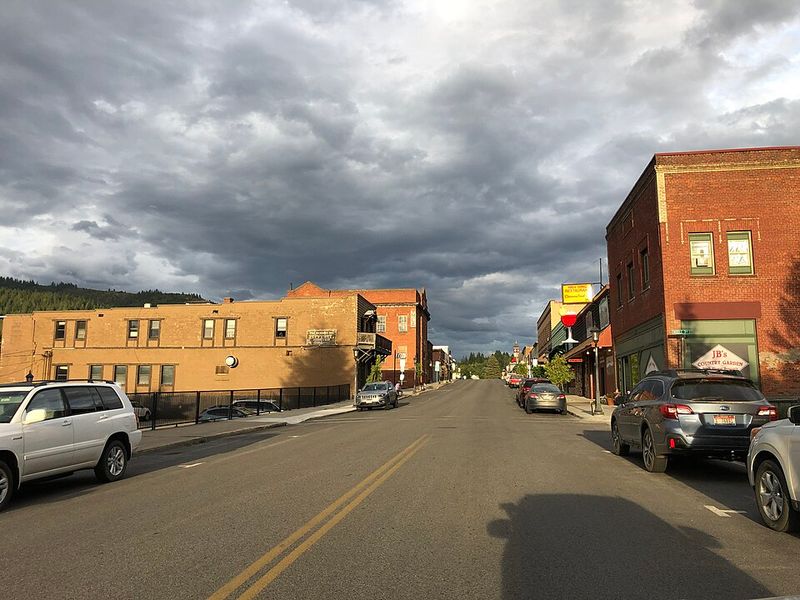
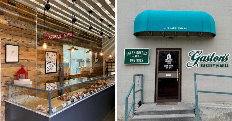
Harrison, Kellogg, Wallace, Smelterville, Pinehurst, Cataldo, and other communities give riders several places to pause, eat, refill bottles, or step away from the pavement.
Services vary considerably, so a town name on the map should not be treated as a guarantee of open restaurants, bicycle repair, or drinking water.
Harrison, Kellogg, and Wallace generally provide the strongest visitor infrastructure, including food, lodging, rentals, and shuttle options. Smaller trailheads may offer parking, picnic tables, or vault toilets without potable water.
Carry enough to reach the next confirmed supply rather than depending on an unverified fountain. The towns add more than practical support.
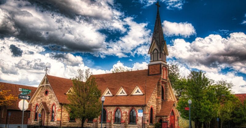
Historic storefronts, former industrial buildings, rail history, and mountain streets reveal how transportation and mining shaped the corridor long before cyclists arrived.
A quick stop can easily turn into lunch, a museum visit, or a walk through several blocks of historic architecture.
Build extra time into the schedule when a town matters to the day’s plan. Rushing through Wallace or Harrison only to protect an ambitious mileage goal can mean missing one of the trail’s most memorable features.
The communities are part of the experience, not interruptions between scenic sections. A planned pause can become the day’s best memory.
Let The Long, Paved Route Keep The Ride Easy
Pavement removes loose surfaces, roots, and technical obstacles found on mountain-bike trails, but 73 miles still requires preparation.
The former railroad alignment keeps most grades gentle, making the route approachable for cyclists, walkers, skaters, wheelchair users, and permitted Class 1 or Class 2 e-bikes.
Class 3 e-bikes remain prohibited. Twenty developed trailheads allow riders to choose a manageable section instead of committing to the complete crossing.
Wind, summer heat, bridge approaches, accumulated distance, and the gradual rise toward Mullan can still change how easy the route feels.
Picnic areas and vault toilets appear along the corridor, but they are not spaced at guaranteed intervals, and drinking water is not consistently available.
Pack food, sun protection, repair supplies, and more water than expected. Stay to the right, announce passes, and expect slower riders or walkers near popular access points.
Families and returning cyclists may prefer the flatter chain-of-lakes sections, while stronger riders can build longer point-to-point days around town stops. The pavement makes the trail welcoming, but careful pacing keeps that welcome intact.
Turning around early is better than discovering too late that the return distance exceeds the group’s remaining energy. Good judgment matters more than arbitrary distance on every outing.
Cross Quiet Stretches Where The Scenery Does The Work
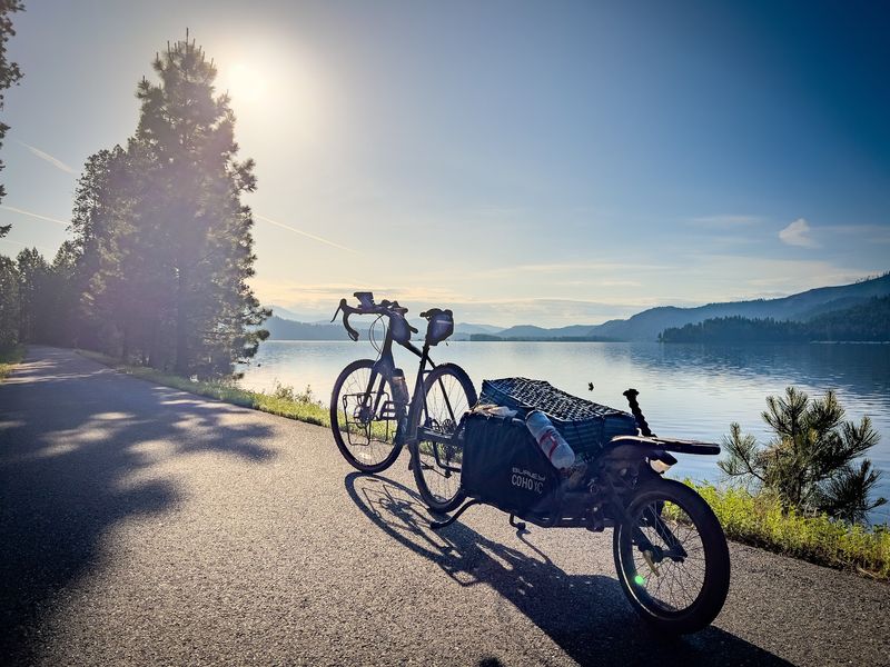
Spaces between busy trailheads allow the river, wetlands, forest, and mountain walls to dominate the ride. Around Medimont, Cataldo, and the chain-of-lakes region, the pavement often follows water with few buildings competing for attention.
Other sections enter shaded forest or narrow valley where the next community remains out of sight for several miles.
Weekday mornings can feel especially peaceful, though solitude also means another rider may not appear quickly after a flat tire or mechanical problem.
Download the official maps, carry a repair kit, and tell someone which section you plan to ride. Cell service may weaken in remote areas, so an offline route is more reliable than depending on a live map.
The corridor has a complicated industrial history. Asphalt and protective layers help isolate contaminated material left beneath portions of the former railroad bed.
Visitors should remain on the paved trail and use designated picnic areas rather than disturbing the shoulders or nearby soil. Private land, docks, and homes border many miles as well.
Respecting those boundaries protects the landscape and keeps the route welcoming. Quiet sections feel most rewarding when practical preparation has removed avoidable worries from the day.
Prepared riders can simply settle into the landscape.
Plan A Section Ride If You Do Not Want All 73 Miles
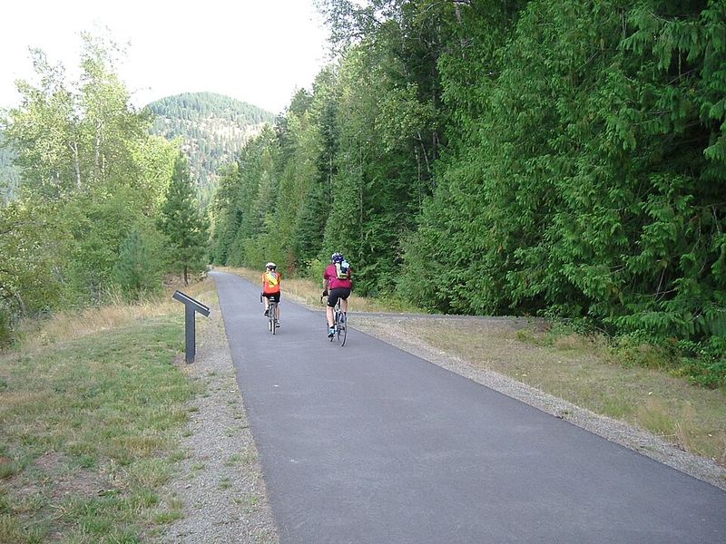
Twenty developed trailheads make the route easy to divide into shorter rides that match the group’s time, fitness, and experience.
The Harrison-to-Chatcolet direction follows Lake Coeur d’Alene toward the bridge, while the Enaville and Cataldo area offers a flatter river section with services near both ends.
Wallace, Kellogg, Plummer, and Mullan also provide useful starting points for riders interested in town access or the mountain character of the eastern miles.
A family outing may work best as a short out-and-back with a picnic stop, while stronger cyclists can leave vehicles at separate trailheads or reserve a commercial shuttle for a longer point-to-point day.
Rentals and shuttle services operate in several communities, but current schedules and reservations should be confirmed before arrival.
Construction, wildfire restrictions, road work, or seasonal maintenance can temporarily change parking and access around particular trailheads.
Check the latest official notice before choosing the starting point. Mileage matters less than matching the route to the people riding it.
A well-planned 10-mile section can provide lake views, wetlands, wildlife, and a town stop without turning the day into an endurance test. The remaining miles will still be there for another visit.
Smaller rides often leave more time for scenery.
Save Time For Wallace, Harrison, And Other Trail Town Stops
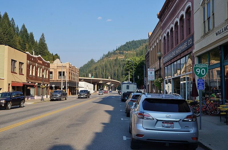
Wallace and Harrison show how dramatically the atmosphere can change along one connected trail. Wallace sits within the Silver Valley, where a nationally recognized historic downtown preserves the shape of a community built around railroads and mining.
Museums, old storefronts, mountain streets, and the Center of the Universe marker give riders several reasons to step away from the saddle. Harrison offers a completely different pause beside Lake Coeur d’Alene, with waterfront views, food, lodging, bicycle services, and direct trail access.
Kellogg adds another practical base with restaurants, rentals, lodging, and nearby recreation at Silver Mountain. These communities are not merely convenient gaps between scenic sections.
They explain how the corridor evolved from an industrial transportation route into a recreational path linking towns across northern Idaho.
Opening hours can change by day and season, so confirm any museum, restaurant, rental counter, or shuttle that feels essential to the plan.
Leave enough time to walk a few blocks without watching the clock. Historic buildings and street patterns provide context that cannot be absorbed while rolling past at cycling speed.
A slower stop can add more to the day than another rushed stretch of mileage. Those pauses give the route its human scale.
Finish With A Bike Day That Feels Bigger Than Expected
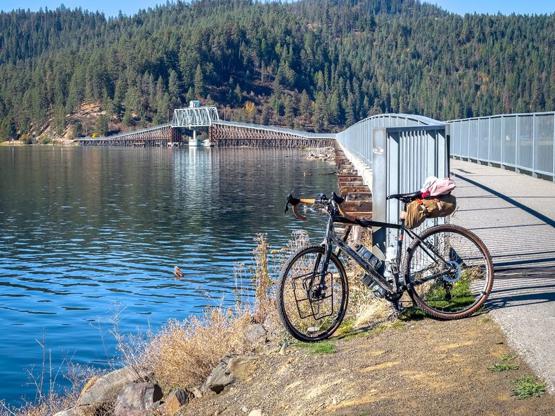
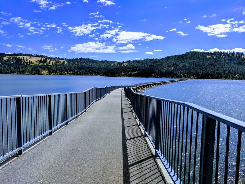
Chatcolet Bridge carries the trail across open water at Heyburn State Park and creates one of the route’s most recognizable moments.
The 3,100-foot structure once served trains moving through the region and now gives cyclists a long, exposed crossing with lake views opening on both sides.
Its former movable section allowed boats to pass, while nearby operations supported the bridge during its railroad years. Today, the approach offers a clear sense of distance as the shoreline falls behind and forested hills spread across the horizon.
Crossing in the opposite direction changes the sequence of views, making the bridge feel different on the return.
Stop only where doing so leaves enough room for other users, and keep control on the approaches when trail traffic is heavier.
Wind can also feel stronger over the water than it did in the protected forest.
By the end of a section ride, the day often feels larger than the mileage suggests because farmland, canyon, wetlands, river, lake, bridge, mountain valley, and historic towns have all appeared within one connected corridor.
That variety, rather than finishing every mile at once, is the strongest reason to return. The bridge makes that return feel inevitable on future visits.