This Idaho Trail Leads Past Gothic-Looking Trees, Alpine Wildflowers, And Jaw-Dropping Mountain Views
The hike is almost suspiciously short for what waits at the top.
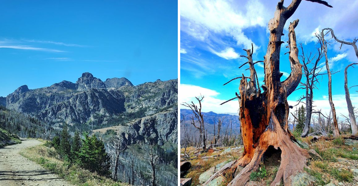
High in Idaho’s mountains, a trail climbs through weather-beaten pines that twist into strange shapes under years of wind and snow. The landscape feels increasingly dramatic with every step, yet the lookout arrives before your legs have much time to complain.
Then the horizon opens.
From roughly 8,400 feet, the view stretches across enormous folds of mountain country and deep river canyons. On an exceptionally clear day, the distance seems to keep going long after you expect it to stop.
The real adventure may actually happen before the hike begins.
Reaching the trailhead requires a steep forest road that becomes rough and narrow near the top, making the drive far less casual than the walk itself.
Idaho saves the hardest part for the car.
Your hiking boots get off surprisingly easy.
Walk Beneath Trees That Look Straight Out Of A Gothic Painting
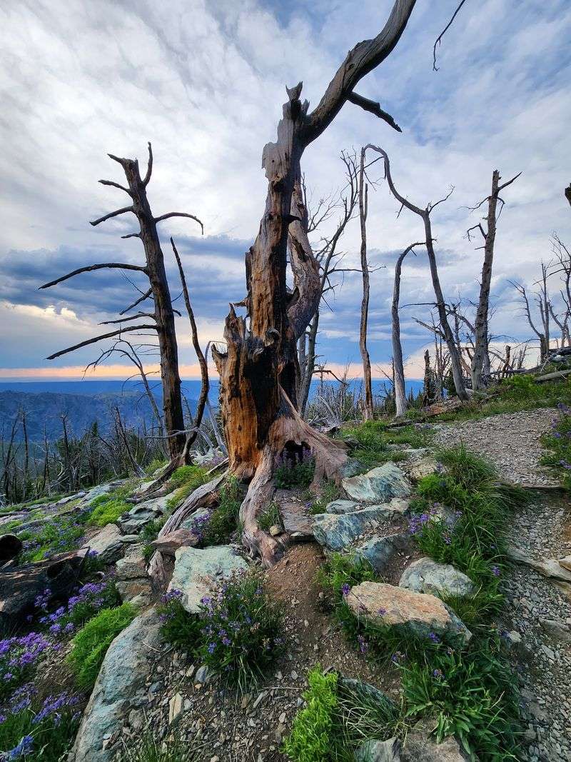
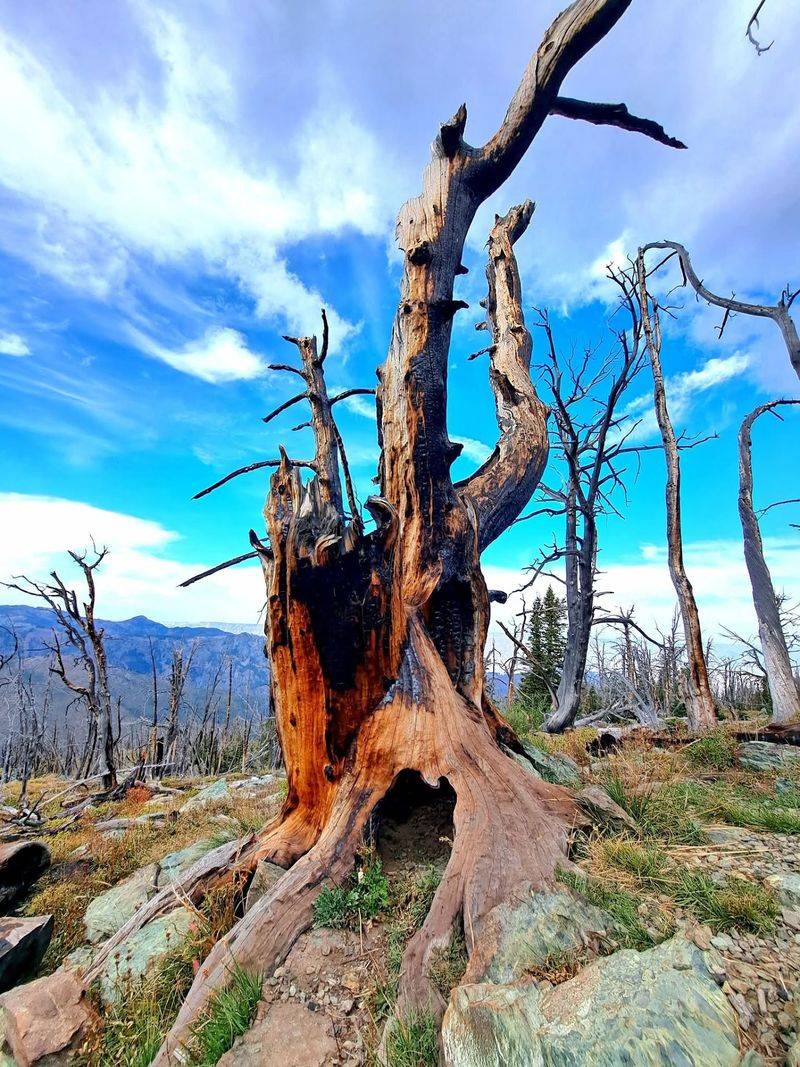
Harsh mountain weather is partly responsible for the unusual trees that give this short trail so much personality. Forest Service vegetation research identifies whitebark pine as the dominant tree on exposed Seven Devils sites around Heaven’s Gate, particularly between roughly 8,000 and 8,500 feet.
These are cold, rocky places where snow can linger late and strong weather repeatedly works against normal upright growth.
Whitebark pine is especially well adapted to high ridges and can develop stunted or irregular forms near timberline, creating the twisted silhouettes that make the trees along Heaven’s Gate Trail look almost illustrated.
Engelmann spruce also occurs in these high-elevation communities, while subalpine fir may appear where conditions allow.
The most exposed surfaces are particularly demanding, with thin, stony soils and little protection from wind.
That environment is more interesting than a generic description of “pine forest” suggests. Trees can appear sparse, weathered, and separated by open rocky ground rather than forming a dense wall of green.
Heaven’s Gate Trailhead puts hikers directly into this subalpine setting without requiring miles of climbing from the canyon below. Those weather-beaten forms are what give the short trail its unusually dramatic silhouettes.
These are trees shaped by elevation and exposure, and their weather-beaten appearance gives the opening stretch of the hike a character that feels completely different from the dry country around Riggins far below.
Keep An Eye Out For Wildflowers Along The Higher Slopes
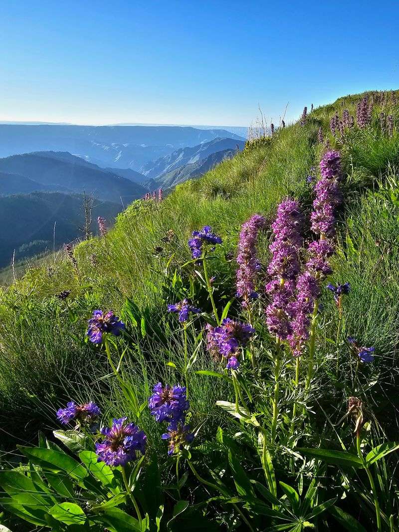
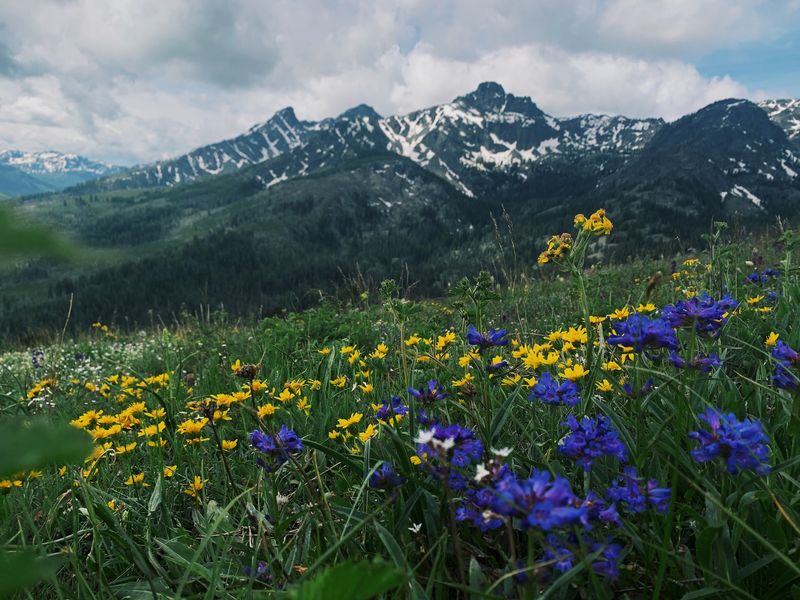
Color fills the open ground once snow has released the higher slopes for summer.
Wildflowers are well documented throughout the Seven Devils, and Forest Service studies of the vegetation near Heaven’s Gate identify alpine and subalpine plants adapted to rocky ridges where the growing season is short.
Tailcup lupine, alpine daisy, leafy aster, thick-leaved groundsel, alpine knotweed, polemonium, and prickly sandwort are among the plants associated with these exposed communities.
Other species occupy protected pockets where late snowmelt leaves moisture behind.
That makes the display highly dependent on the year. A heavy snow season can postpone flowering, while warmer conditions can bring the high-country bloom forward and shorten it.
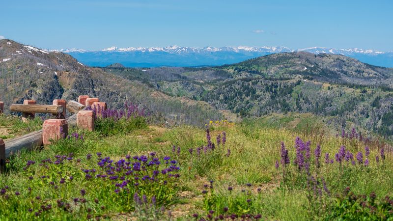
Visit Idaho’s coverage of the Seven Devils also shows broad wildflower meadows in this landscape, confirming that the color is not limited to a few isolated blooms beside the road.
Heaven’s Gate Trail is especially convenient for enjoying that high-elevation vegetation because hikers begin near 8,100 feet instead of spending hours climbing through lower forest first.
Remaining on the established path matters in these exposed areas.
Pause Often Because The Mountain Views Keep Getting Better
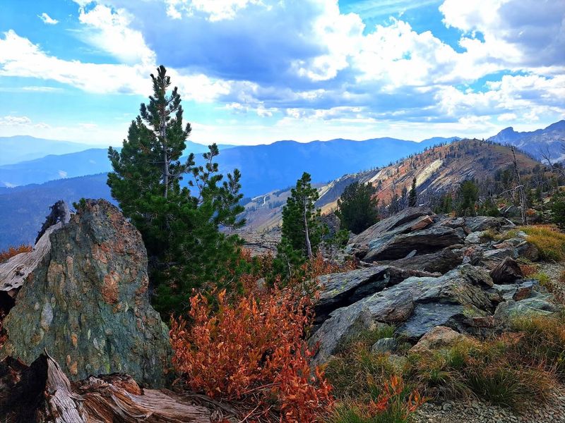
The scenery begins before the lookout itself comes into view. Heaven’s Gate Trail starts at roughly 8,150 feet and climbs toward a high point around 8,430 feet, so even the parking area is already sitting above a huge portion of the surrounding landscape.
The short route gains roughly 275 to 340 feet depending on the mapping source, enough to continually open the view as the trail wraps upward. To the south and southwest, the jagged Seven Devils dominate the skyline.
In other directions, deep river canyons cut through the country below, including Hells Canyon and the Salmon River Canyon. Forest Service planning documents specifically identify outstanding views of both the Snake and Salmon River canyon systems from the Heaven’s Gate area.
The famous four-state view requires the right conditions rather than simply reaching the top.
On a very clear day, distant mountain country in Idaho, Oregon, Washington, and Montana can be visible, a claim repeated by regional tourism authorities and long associated with the lookout.
Smoke, haze, clouds, or summer wildfire conditions can shorten that distance considerably. That uncertainty is part of why it is worth stopping more than once on the climb instead of treating the lookout as the only place that matters.
Heaven’s Gate Trail may cover less than half a mile in one direction, but nearly every rise changes the angle toward the peaks and canyons.
Look Across Hells Canyon From One Of The Best Vantage Points
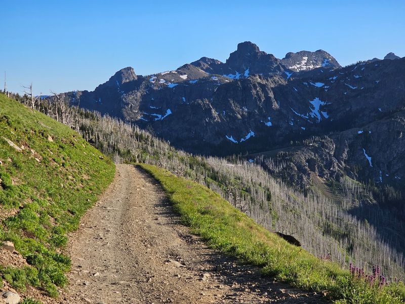
Hells Canyon is the view that gives this little summit walk its enormous sense of scale. Heaven’s Gate Lookout stands at approximately 8,429 feet near the eastern side of the Hells Canyon National Recreation Area, with the canyon country dropping dramatically away toward the Snake River.
The lookout is an active fire-observation site with a history stretching back more than a century. A lookout camp existed here in the 1920s, a cabin with a cupola followed in 1924, and the present structure dates to 1978.
Independent lookout records documented it as staffed during fire season as recently as 2024, although hikers should not assume the building will be open or that a staff member will be available during a particular visit.
The panorama is the dependable attraction.
From the Heaven’s Gate area, visitors can see across the Seven Devils and into the Snake and Salmon River canyons. Regional tourism sources also note that clear conditions may reveal views into four states.
The tower is therefore best treated as a viewpoint rather than a guaranteed visitor center.
Heaven’s Gate Trail brings hikers to the base of that historic structure after only about 0.4 mile of walking, creating one of those rare situations where the road demands substantially more patience than the hike.
Once above the trees, the scale of Hells Canyon makes that long gravel approach feel much smaller.
Expect A Wild, Windy Feel Once You Reach The Higher Ground
Exposure comes with the territory once the trail rises above 8,000 feet. Forest Service vegetation research describes the Heaven’s Gate ridge environment as cold and windy enough that some exposed locations are too harsh for true fir to establish permanently.
Whitebark pine dominates many of those sites precisely because it can survive conditions that are difficult for less specialized trees. That same exposure matters to hikers.
Temperatures at the trailhead can be dramatically cooler than they were down in Riggins, and a calm summer afternoon in the canyon does not guarantee calm conditions on the ridge. Carrying an extra layer makes sense even though the walk is short.
Elevation is another reason not to judge the outing entirely by mileage. Heaven’s Gate Trail begins above 8,000 feet and climbs several hundred feet in less than half a mile, so anyone arriving directly from lower elevations may notice the thin air more than the distance itself.
The mileage is modest, but the altitude can make the climb feel more noticeable for hikers arriving from much lower elevations. Exposed ridges also deserve respect when thunderstorms are developing.
Forest Service guidance for Hells Canyon Wilderness emphasizes checking current conditions, while the high open terrain around the lookout offers little reason to linger if lightning is nearby.
Bring A Camera For The Strange Trees And Wide-Open Scenery
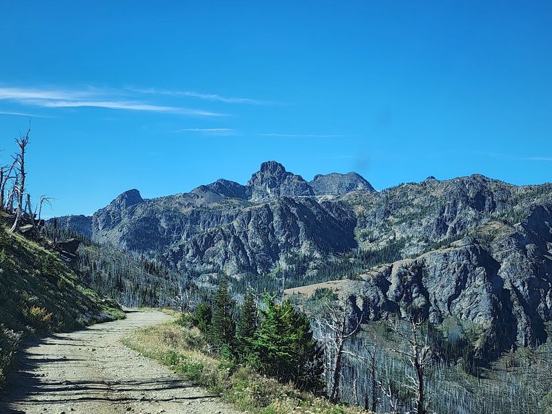
Few short trails change photographic subjects this quickly. One section can be dominated by contorted whitebark pine, while the next opens toward wildflower-covered slopes and the sharp skyline of the Seven Devils.
Higher up, Hells Canyon and distant mountain ranges push the scale outward again. Visit Idaho has specifically highlighted Heaven’s Gate as a strong photography location, including its south-facing view toward the Seven Devils for night-sky photography.
Its travel coverage notes that the alignment can work especially well for photographing the Milky Way above the mountains when conditions cooperate. Daylight offers plenty without requiring specialized equipment.
Wide views from the lookout include rugged peaks and deep canyon country, while the weathered trees give photographers a much closer subject than the distant horizon.
Night photography still depends on smoke, clouds, moonlight and seasonal access, so conditions should be checked before making the long drive specifically for the sky.
Smoke, cloud cover, moonlight, road access, and seasonal weather can all change the experience. The more reliable reason to bring a camera is simply the variety packed into such a short route.
Heaven’s Gate Trail climbs less than half a mile from its trailhead to the lookout but moves through one of the most exposed and visually distinctive portions of the Seven Devils high country.
Choose Summer If You Want The Best Mix Of Flowers And Clear Views
Summer offers the most practical combination of road access, wildflowers, and comfortable hiking conditions, but the exact opening window is controlled by mountain weather rather than a fixed calendar date.
Forest Road 517 climbs into terrain above 8,000 feet, where snowpacks persist late enough to shorten the growing season.
Forest Service vegetation studies around Heaven’s Gate specifically note late-lasting snow on these upper slopes, while current road guidance warns that the route can become slippery when wet or frozen. That makes late spring an unreliable time to assume the final miles will be passable.
Mid- and late summer generally provide the strongest chance of reaching the trailhead while also catching alpine vegetation in bloom.
September can remain attractive as well, although cold mornings and early-season snow become increasingly possible as autumn advances.
Wildfire smoke deserves consideration in late summer because the famous long-distance views depend heavily on clear air. The four-state panorama is a possibility, not a guarantee.
Before committing to the drive, hikers can contact the Forest Service office in Riggins for current trail and access information. That check matters more here than choosing one supposedly perfect week.
Know The Road In Can Be Almost As Adventurous As The Hike
The short hike begins only after a much longer climb by vehicle. From Riggins, drivers travel south on U.S. 95 for about 1.3 miles before turning onto Seven Devils Road, which becomes Forest Road 517.
The Forest Service places Windy Saddle roughly 17 miles up that route, with Heaven’s Gate continuing beyond it toward the end of the road.
Independent route descriptions put the total drive from the highway to the lookout area at roughly 18 to 19 miles.
More important than the mileage is the condition of the upper road. The Forest Service describes Forest Road 517 as very steep and narrow and specifically warns against low-clearance vehicles, RVs, and trailers in its upper sections.
Wet or frozen conditions can make the surface slippery, and trailers are especially discouraged in late fall and winter.
A four-wheel-drive vehicle is not officially required for the approach to Windy Saddle, but clearance and careful driving are useful advantages on a rough mountain road.